Bex
Bex (German: Beis) is a municipality in the canton of Vaud, Switzerland. It is in the district of Aigle. It has an area of 96.60 km², an altitude of 424 m, and a population of about 5709. It is a few miles south of its sister town municipality of Aigle.
 | |
 Coat of arms | |
Location of Bex
Lua error in Module:Infobox_mapframe at line 118: attempt to index field 'wikibase' (a nil value).
| |
| Coordinates: 46°15′N 7°1′E / 46.250°N 7.017°ECoordinates: 46°15′N 7°1′E / 46.250°N 7.017°E | |
| Country | Switzerland |
| Canton | Vaud |
| District | Aigle |
| Government | |
| • Mayor | Syndic Pierre Rochat |
| Area | |
| • Total | 96.56 km2 (37.28 sq mi) |
| Elevation | 424 m (1,391 ft) |
| Population (2003) | |
| • Total | 5,751 |
| • Density | 59.559/km2 (154.257/sq mi) |
| Time zone | UTC+01:00 (Central European Time) |
| • Summer (DST) | UTC+02:00 (Central European Summer Time) |
| Postal code(s) | 1880 |
| Surrounded by | Chamoson (VS), Collonges (VS), Conthey (VS), Fully (VS), Gryon, Lavey-Morcles, Leytron (VS), Massongex (VS), Monthey (VS), Ollon, Ormont-Dessus, Saint-Maurice (VS) |
| Twin towns | Tuttlingen (Germany) |
| Website | www Profile (in French), SFSO statistics |
Geography
Bex sits on the east side of the Rhône river in a big valley bordered on the east by the Bernese Alps and west by the Chablais Alps. Famous Swiss and French ski resorts are nearby. It is on Swiss National Route 9. Bex is connected to Les Diablerets by the mountain pass Col de la Croix
Bex Media

- The river running through the salt mines of Bevieux, Bex, Switzerland. Line engraving by J. J. Maillet after Barbier Laine. Iconographic Collections*Keywords: Jean Joseph Maillet; Barbier Laine

- Tiefgeflogen

Place du Marché. Note the vineyards in background

Solalex alpine pastures dominated by the Diablerets

This is an image of a cultural property of regional significance in Switzerland with KGS number

Les Plans-sur-Bex chapel dominated by the Grand Muveran

Bex–Villars train passing through the Rue Centrale
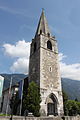
Clocher de l'église de Bex (Suisse)

Bex, salt mine (Canton Vaud, Switzerland)


References
Other websites
![]() Media related to Bex at Wikimedia Commons
Media related to Bex at Wikimedia Commons
- Official website (in French)