Derbyshire
Derbyshire is a county in the East Midlands of England. A large part of the Peak District National Park lies within Derbyshire.
| Derbyshire | |
|---|---|

| |
| Geography | |
| Status | Ceremonial & (smaller) Non-metropolitan county |
| Region | East Midlands |
| Area - Total - Admin. council - Admin. area |
Ranked 21st 2,625 km2 (1,014 sq mi) Ranked 20th |
| Admin HQ | Matlock |
| ISO 3166-2 | GB-DBY |
| ONS code | 17 |
| NUTS 3 | UKF12/13 |
| Demography | |
| Population - Total (2005 est.) - Density - Admin. council - Admin. pop. |
Ranked 20th 981,200 373/km2 (970/sq mi) Ranked 11th 747,500 |
| Ethnicity | 96.0% White 2.3% S.Asian |
| Politics | |
| Derbyshire County Council http://www.derbyshire.gov.uk/ | |
| Executive | Labour |
| Members of Parliament | |
| Districts | |

| |
The northern part of Derbyshire overlaps with the Pennines, a famous chain of hills and mountains. The county contains part of the National Forest, and borders on Greater Manchester, West Yorkshire, South Yorkshire, Nottinghamshire, Leicestershire, Staffordshire and Cheshire.
Places of interest
- Chatsworth — a stately home
- Crich Tramway Village, Crich
- Derwent Valley Mills — a World Heritage Site
- Hob Hurst's House — English Heritage
- Nine Ladies Stone Circle — English Heritage
- Sutton Scarsdale Hall — English Heritage
- Wingfield Manor — English Heritage
- Creswell Crags — pending World Heritage Site proposal
Geology
Derbyshire can only be understood by its ancient geology. Most of the geology was laid down in a tropical paradise in the equatorial region of the Earth.

Northern Derbyshire is an uplifted dome of rock layers. These layers have been eroded to expose older rocks in the centre of the Derbyshire Dome. They are encircled by younger limestone rocks. They give way on three sides to Upper Carboniferous shales, gritstones and sandstones of Namurian age (331 to 315 mya).
South of Buxton much of the land is difficult to walk on, and roads are narrow and winding. This area was once a tropical paradise with scattered calcium carbonate reefs. This coarse sandstone was much used for gritstone grinding wheels for use in mills.
| UNESCO World Heritage Site | |
|---|---|
 Masson Mills, Derwent Valley | |
| Location | Derbyshire, England |
| Criteria | Cultural: ii, iv |
| Reference | 1030 |
| Inscription | 2001 (25th Session) |
| Area | 1,228.7 ha |
| Buffer zone | 4,362.7002 ha |
| Website | www |
| Coordinates | 53°1′44″N 1°29′17″W / 53.02889°N 1.48806°W |
Derbyshire Media

Derbyshire UK locator map 2010
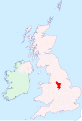
Derbyshire - British Isles

Derbyshire numbered districts

The henge monument at Arbor Low

Hand-drawn map of Derbyshire by Christopher Saxton in 1577

Green belts in Derbyshire and beyond.*Clockwise from top left:*North West Green Belt*South and West Yorkshire Green Belt*Nottingham and Derby Green Belt*Burton upon Trent and Swadlincote Green Belt*West Midlands Green Belt*Stoke-on-Trent Green Belt

Map of Derbyshire boundaries with Peak District also shown. Black=modern Geographic boundary, Red=Vice-county boundary (VC57) where this differs from modern; Dotted Blue=Peak District boundary

The rugged moorland edge of the southern Pennines at Kinder Downfall

The ruins of the Magpie Mine near Sheldon


