File:"Township 15 North, Range 10 West," from Atlas Map of Morgan County, Illinois.jpg
Size of this preview: 495 × 600 pixels. Other resolutions: 198 × 240 pixels | 620 × 751 pixels.
Original file (620 × 751 pixels, file size: 135 KB, MIME type: image/jpeg)
| This is a file from the Wikimedia Commons. The description on its description page there is shown below.
|
Summary
| Description |
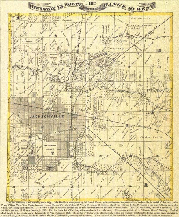
English: Map of Township 15 North, Range 10 West from Atlas Map of Morgan County, Illinois. Originally produced in Davenport, Iowa by Andreas, Lyter & Co. in 1872.
An atlas map from 1872 showing Portuguese landowners living near Jacksonville. |
| Date | |
| Source | https://www.loc.gov/rr/hispanic/portam/jacksonville.html |
| Author | Andreas, Lyter & Co. |
Licensing
|
This work is in the public domain in its country of origin and other countries and areas where the copyright term is the author's life plus 100 years or fewer. This work is in the public domain in the United States because it was published (or registered with the U.S. Copyright Office) before January 1, 1929. | |
| This file has been identified as being free of known restrictions under copyright law, including all related and neighboring rights. | |
File history
Click on a date/time to view the file as it appeared at that time.
| Date/Time | Dimensions | User | Comment | |
|---|---|---|---|---|
| current | 18:03, 18 June 2020 | 620 × 751 (135 KB) | TazmilyKoala | Uploaded a work by Andreas, Lyter & Co. from https://www.loc.gov/rr/hispanic/portam/jacksonville.html with UploadWizard |
File usage
The following page uses this file: