File:Расположение провинции Пфальц на карте Германской империи.svg

Size of this PNG preview of this SVG file: 707 × 600 pixels. Other resolutions: 283 × 240 pixels | 566 × 480 pixels | 905 × 768 pixels | 1,207 × 1,024 pixels | 2,621 × 2,224 pixels.
Original file (SVG file, nominally 2,621 × 2,224 pixels, file size: 475 KB)
| This is a file from the Wikimedia Commons. The description on its description page there is shown below.
|
Summary
| Description |
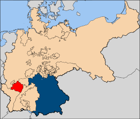
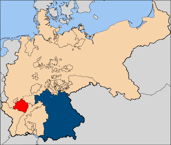
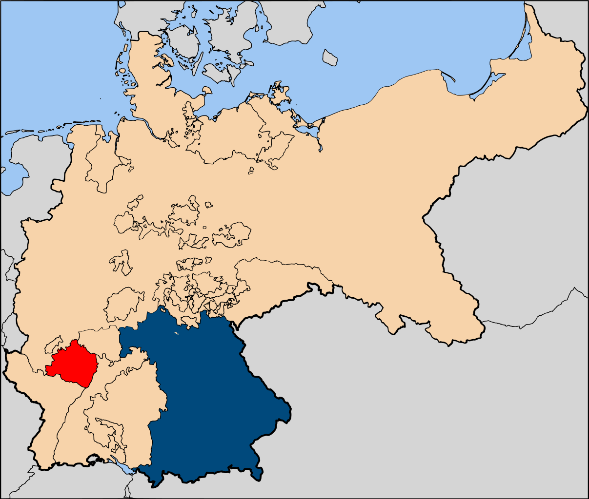
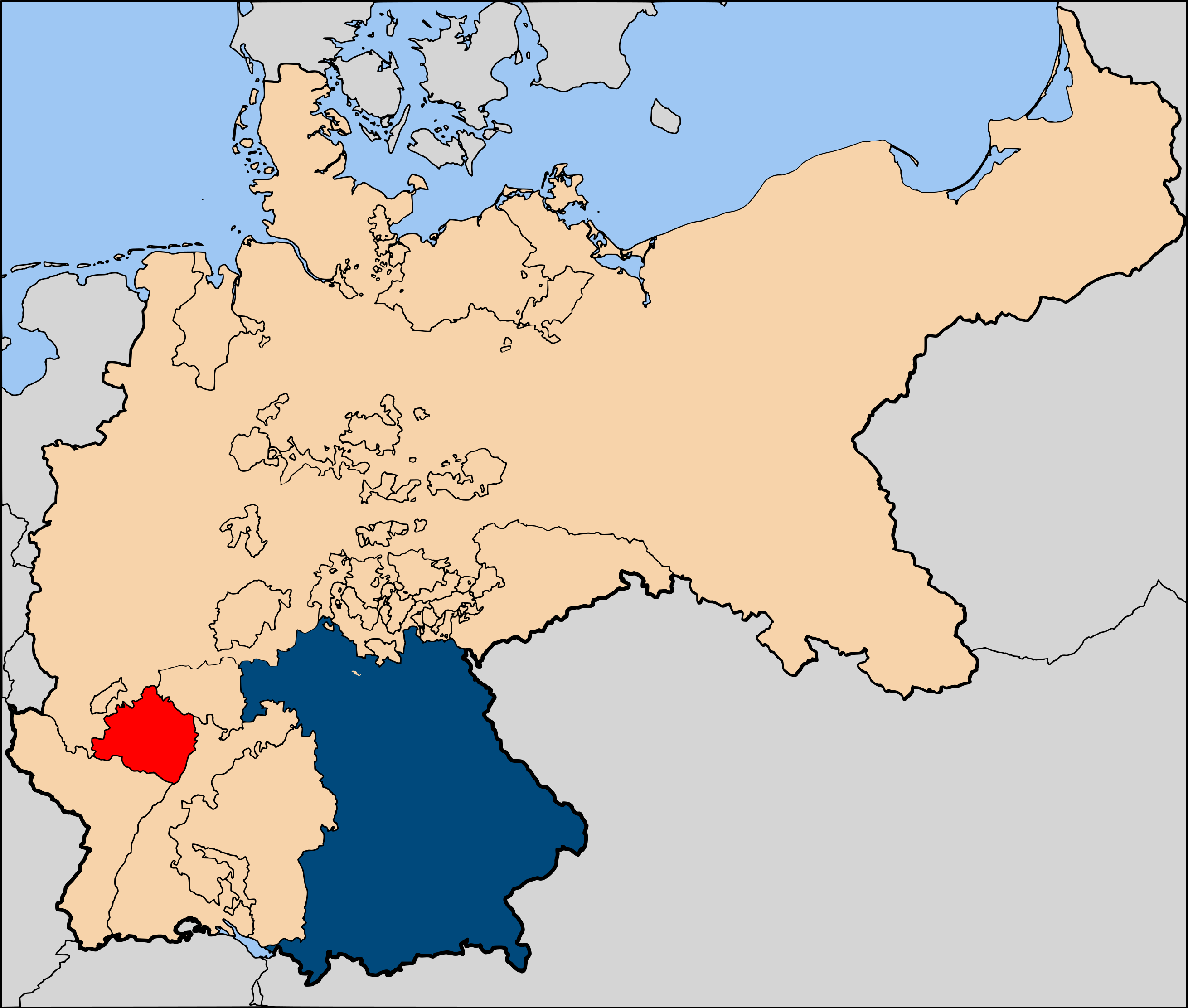
Русский: Расположение провинции Пфальц королевства Бавария на карте Германской империи. |
| Date | |
| Source | Own work |
| Author | Vasyatka1 |
Собственная работа, выполненная в "Adobe Illustrator", на основе SVG-карт выложенных на "Викискладе".
А именно, в качестве исходника использовался файл: ![]()
Licensing
| I, the copyright holder of this work, release this work into the public domain. This applies worldwide. In some countries this may not be legally possible; if so: I grant anyone the right to use this work for any purpose, without any conditions, unless such conditions are required by law. |
File history
Click on a date/time to view the file as it appeared at that time.
| Date/Time | Dimensions | User | Comment | |
|---|---|---|---|---|
| current | 06:24, 27 June 2009 | 2,621 × 2,224 (475 KB) | Vasyatka1 | {{Information |Description={{ru|1=Расположение провинции Пфальц королевства Бавария на карте Германской империи.}} |Source=Own work by uploader |Author=Vasyatka1 |Date |
File usage
The following page uses this file: