File:1997 Red River Flood Grand Forks.jpg
Size of this preview: 757 × 600 pixels. Other resolutions: 303 × 240 pixels | 606 × 480 pixels | 970 × 768 pixels | 1,280 × 1,014 pixels | 1,500 × 1,188 pixels.
Original file (1,500 × 1,188 pixels, file size: 812 KB, MIME type: image/jpeg)
| This is a file from the Wikimedia Commons. The description on its description page there is shown below.
|
| Description |
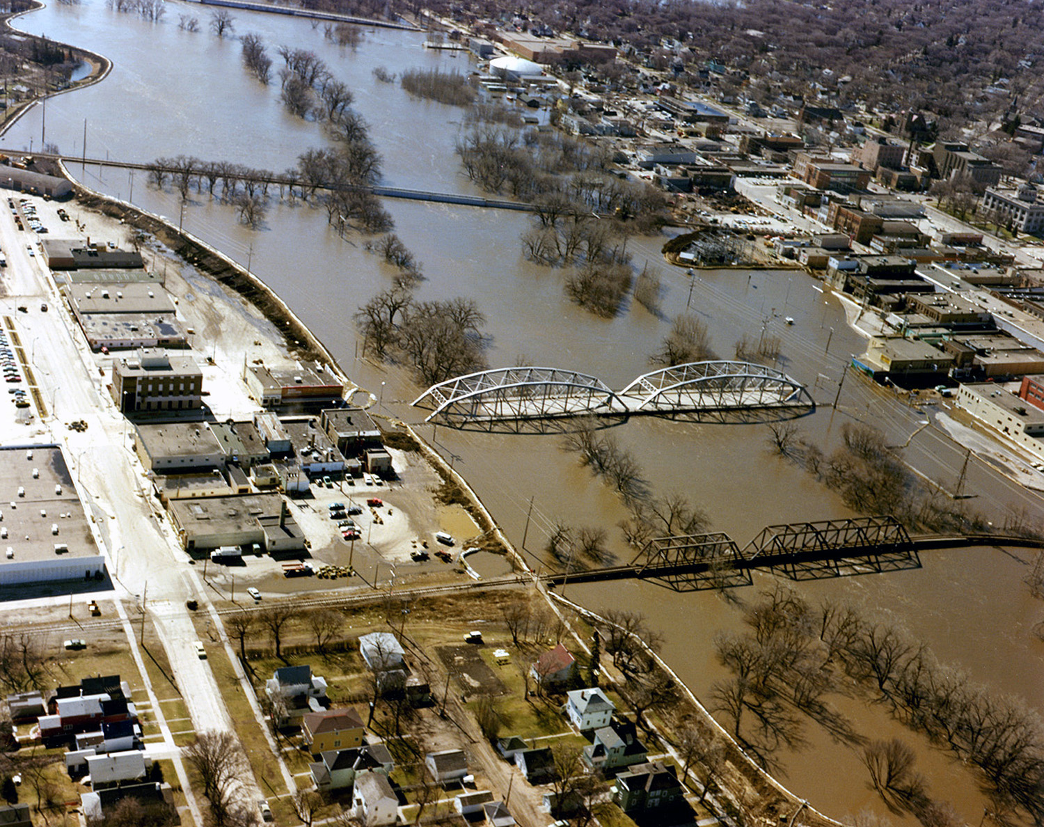
English: The Red River in flood in April or May 1997 in Grand Forks, North Dakota and East Grand Forks, Minnesota. |
|||
| Date | ||||
| Source |
U.S. Army Corps of Engineers Digital Visual Library Image page Image description page Digital Visual Library home page |
|||
| Author | Ken Gardner, U.S. Army Corps of Engineers | |||
| Permission (Reusing this file) |
|
|||
| Location | Grand Forks, North Dakota and East Grand Forks, Minnesota, USA |
| Camera location | | View this and other nearby images on: OpenStreetMap |
|---|
File history
Click on a date/time to view the file as it appeared at that time.
| Date/Time | Dimensions | User | Comment | |
|---|---|---|---|---|
| current | 20:21, 4 December 2016 | 1,500 × 1,188 (812 KB) | HopsonRoad | Improve color balance. |
File usage
The following page uses this file: