File:20111224 Flavius Marcianus Augustus Column Fatih Istanbul Turkey.jpg
Size of this preview: 399 × 600 pixels. Other resolutions: 160 × 240 pixels | 319 × 480 pixels | 511 × 768 pixels | 681 × 1,024 pixels | 2,832 × 4,256 pixels.
Original file (2,832 × 4,256 pixels, file size: 4.75 MB, MIME type: image/jpeg)
This is a file from the Wikimedia Commons. The description on its description page there is shown below.
|
Summary
Description20111224 Flavius Marcianus Augustus Column Fatih Istanbul Turkey.jpg |
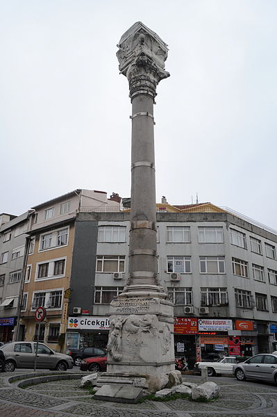
English: The column of Emperor Marcian, Fatih, Istanbul, Turkey.
Ελληνικά: Η στήλη του αυτοκράτορα Μαρκιανού, Φατίχ, Κωνσταντινούπολη, Τουρκία. |
|||||||
Date | ||||||||
Source |
Ggia, the copyright holder of this work, hereby publishes it under the following license: This file is licensed under the Creative Commons Attribution-Share Alike 3.0 Unported license. Attribution: Ggia
|
|||||||
Author | User:Ggia |
Camera location | 41° 00′ 55.92″ N, 28° 57′ 00.99″ E | View this and other nearby images on: OpenStreetMap | 41.015533; 28.950274 |
---|
Licensing
I, the copyright holder of this work, hereby publish it under the following license:
This file is licensed under the Creative Commons Attribution-Share Alike 3.0 Unported license.
- You are free:
- to share – to copy, distribute and transmit the work
- to remix – to adapt the work
- Under the following conditions:
- attribution – You must give appropriate credit, provide a link to the license, and indicate if changes were made. You may do so in any reasonable manner, but not in any way that suggests the licensor endorses you or your use.
- share alike – If you remix, transform, or build upon the material, you must distribute your contributions under the same or compatible license as the original.
Items portrayed in this file
depicts
41°0'55.92042"N, 28°57'0.98464"E
24 December 2011
image/jpeg
646347e25ee25dd0deecc61f454eddd4ed077d8f
4,983,799 byte
4,256 pixel
2,832 pixel
File history
Click on a date/time to view the file as it appeared at that time.
Date/Time | Dimensions | User | Comment | |
---|---|---|---|---|
current | 12:12, 14 February 2012 | 2,832 × 4,256 (4.75 MB) | Ggia |
File usage
The following page uses this file:
Metadata
This file contains additional information, probably added from the digital camera or scanner used to create or digitize it.
If the file has been modified from its original state, some details may not fully reflect the modified file.
Camera manufacturer | NIKON CORPORATION |
---|---|
Camera model | NIKON D700 |
Author | {georgios.giannopoulos at gmail.com} |
Copyright holder | 2011 by Georgios Giannopoulos |
Exposure time | 1/100 sec (0.01) |
F Number | f/11 |
ISO speed rating | 400 |
Date and time of data generation | 15:58, 24 December 2011 |
Lens focal length | 28 mm |
Latitude | 41° 0′ 55.92″ N |
Longitude | 28° 57′ 0.98″ E |
Horizontal resolution | 300 dpi |
Vertical resolution | 300 dpi |
Software used | Ver.1.02 |
File change date and time | 21:04, 14 February 2012 |
Y and C positioning | Co-sited |
Exposure Program | Manual |
Exif version | 2.21 |
Date and time of digitizing | 15:58, 24 December 2011 |
Meaning of each component |
|
Image compression mode | 4 |
APEX exposure bias | 0 |
Maximum land aperture | 0 APEX (f/1) |
Metering mode | Pattern |
Light source | Unknown |
Flash | Flash did not fire |
DateTime subseconds | 42 |
DateTimeOriginal subseconds | 42 |
DateTimeDigitized subseconds | 42 |
Supported Flashpix version | 1 |
Color space | sRGB |
Sensing method | One-chip color area sensor |
File source | Digital still camera |
Scene type | A directly photographed image |
Custom image processing | Normal process |
Exposure mode | Manual exposure |
White balance | Auto white balance |
Digital zoom ratio | 1 |
Focal length in 35 mm film | 28 mm |
Scene capture type | Standard |
Scene control | Low gain up |
Contrast | Normal |
Saturation | Normal |
Sharpness | Normal |
Subject distance range | Unknown |
Unique image ID | 5408f16cac99ea9301f688a99451b6fa |
Altitude reference | � |
GPS time (atomic clock) | 12:58 |
Satellites used for measurement | 06 |
Geodetic survey data used | WGS 84 |
GPS date | 24 December 2011 |
GPS tag version | 2.2.0.0 |
IIM version | 4 |