File:Ancestral Puebloan sites.png
Size of this preview: 521 × 599 pixels. Other resolutions: 209 × 240 pixels | 417 × 480 pixels | 522 × 600 pixels | 913 × 1,050 pixels.
Original file (913 × 1,050 pixels, file size: 82 KB, MIME type: image/png)
| This is a file from the Wikimedia Commons. The description on its description page there is shown below.
|
Summary
| Description |
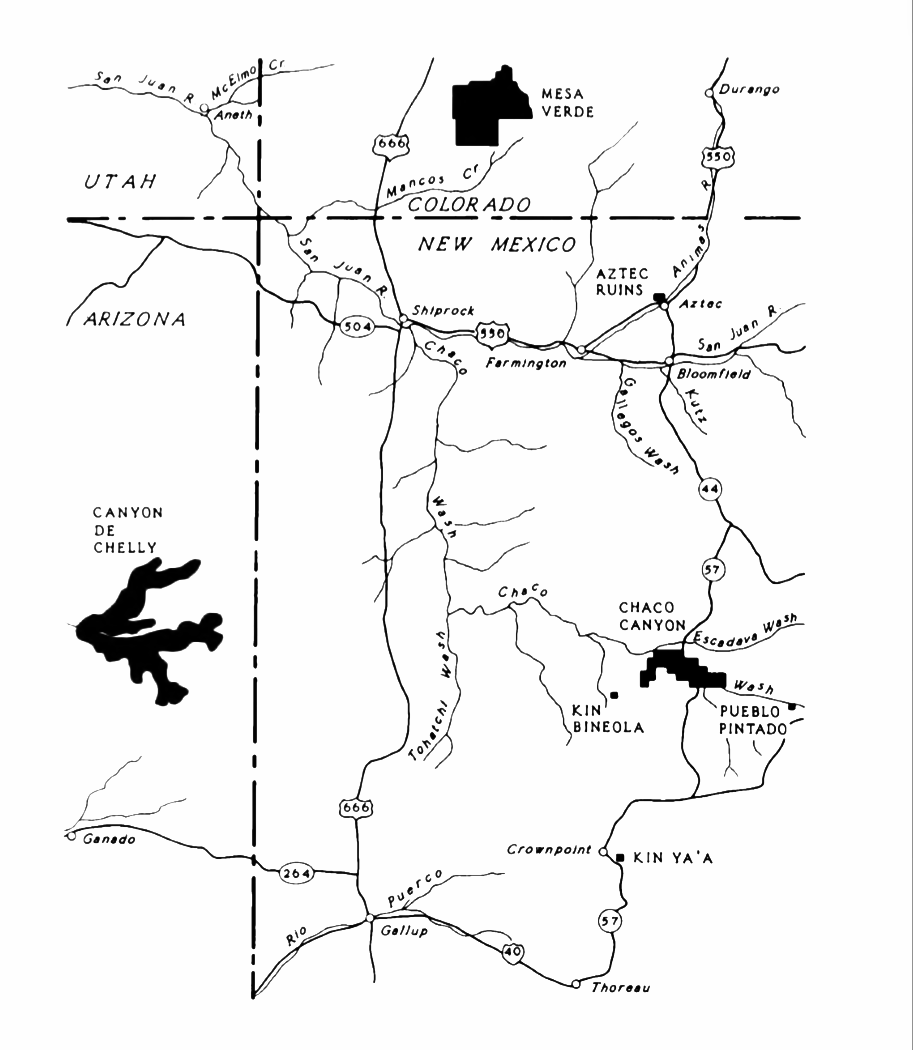
English: An NPS map of Ancestral Puebloan sites in the Four Corners area. |
| Date | |
| Source | Lyons, Thomas R., Remote Sensing Experiments in Cultural Resource Studies: Non-destructive Methods of Archeological Exploration, Survey, and Analysis, Reports of the Chaco Center, No. 1, United States Department of the Interior, National Park Service, page 104. |
| Author | National Park Service |
Licensing
| This image or media file contains material based on a work of a National Park Service employee, created as part of that person's official duties. As a work of the U.S. federal government, such work is in the public domain in the United States. See the NPS website and NPS copyright policy for more information. |
File history
Click on a date/time to view the file as it appeared at that time.
| Date/Time | Dimensions | User | Comment | |
|---|---|---|---|---|
| current | 21:32, 29 February 2016 | 913 × 1,050 (82 KB) | Hotshot977 | Increased contrast and converted to greyscale color space. |
File usage
The following page uses this file: