File:Balkan boundaries1876map1914.png

Original file (984 × 712 pixels, file size: 73 KB, MIME type: image/png)
| This is a file from the Wikimedia Commons. The description on its description page there is shown below.
|

|
This map has been uploaded by Electionworld from en.wikipedia.org to enable the |
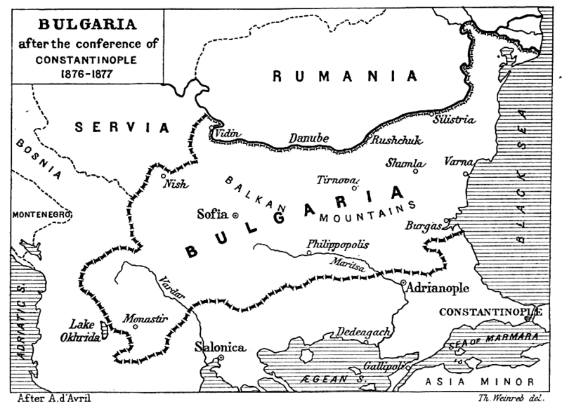
| Description | Map from "Report of the International Commission To Inquire into the Causes and Conduct of the Balkan Wars" 1914. |
| Date | Map printed and published 1914 |
| Source | a map |
| Author | Source: [1] - JPG to PNG by Iain 09:30, 13 June 2006 (UTC) |
| Permission (Reusing this file) |
Original File PD |
| Other versions | Original Image Image:Balkan boundaries1876map1914.jpg now redundant |
|
This work is in the public domain in its country of origin and other countries and areas where the copyright term is the author's life plus 70 years or fewer.
| |
| This file has been identified as being free of known restrictions under copyright law, including all related and neighboring rights. | |
File history
Click on a date/time to view the file as it appeared at that time.
| Date/Time | Dimensions | User | Comment | |
|---|---|---|---|---|
| current | 15:17, 20 December 2006 | 984 × 712 (73 KB) | Electionworld | {{ew|en|Iain}} {{Information| |Description = Map from "Report of the International Commission To Inquire into the Causes and Conduct of the Balkan Wars" 1914. |Date = Map printed and published 1914 |Author = Source: [http://www.lib.utexas.edu/maps/histori |
File usage
The following page uses this file: