File:Bolama sectors.png
Size of this preview: 738 × 599 pixels. Other resolutions: 296 × 240 pixels | 591 × 480 pixels | 739 × 600 pixels | 948 × 770 pixels.
Original file (948 × 770 pixels, file size: 24 KB, MIME type: image/png)
| This is a file from the Wikimedia Commons. The description on its description page there is shown below.
|
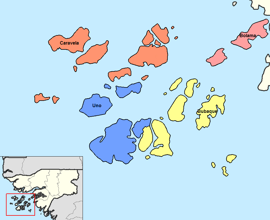
Português: Sectores de Bolama até 2004.
Deutsch: Sektoren der Region Bolama bis 2004.
English: Sectors od the Bolama region until 2004.
Summary
| Description | Map of the sectors of Bolama region of Guinea-Bissau. Created by Rarelibra 14:13, 14 September 2006 (UTC) for public domain use, using MapInfo Professional v8.5 and various mapping resources. |
| Date | 5 January 2008 (original upload date) |
| Source | No machine-readable source provided. Own work assumed (based on copyright claims). |
| Author | No machine-readable author provided. Francofranco56 assumed (based on copyright claims). |
| Other versions |
|

Licensing
| I, the copyright holder of this work, release this work into the public domain. This applies worldwide. In some countries this may not be legally possible; if so: I grant anyone the right to use this work for any purpose, without any conditions, unless such conditions are required by law. |
File history
Click on a date/time to view the file as it appeared at that time.
| Date/Time | Dimensions | User | Comment | |
|---|---|---|---|---|
| current | 03:16, 19 August 2015 | 948 × 770 (24 KB) | Naturals | Uno sector since 2004 |
File usage
The following page uses this file: