File:British and French empires 1920.png

Size of this preview: 800 × 351 pixels. Other resolutions: 320 × 140 pixels | 640 × 281 pixels | 1,425 × 625 pixels.
Original file (1,425 × 625 pixels, file size: 40 KB, MIME type: image/png)
| This is a file from the Wikimedia Commons. The description on its description page there is shown below.
|
Summary
| Description |
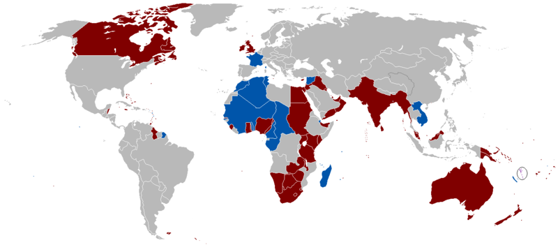
English: A map of the British Empire and French Colonial Empire in 1920. Shared territory is circled. |
||
| Date | Uploaded on 27 August 2008, 21:41. | ||
| Source | Own work. | ||
| Author | Vadac. | ||
| Permission (Reusing this file) |
|
||
| Other versions | File:British Empire 1921.png, File:Empire colonial français (1920).png |
.png)

|
This historical map image could be re-created using vector graphics as an SVG file. This has several advantages; see Commons:Media for cleanup for more information. If an SVG form of this image is available, please upload it and afterwards replace this template with
{{vector version available|new image name}}.
It is recommended to name the SVG file “British and French empires 1920.svg”—then the template Vector version available (or Vva) does not need the new image name parameter. |
File history
Click on a date/time to view the file as it appeared at that time.
| Date/Time | Dimensions | User | Comment | |
|---|---|---|---|---|
| current | 16:34, 7 November 2021 | 1,425 × 625 (40 KB) | Randomastwritter | jubaland |
File usage
The following page uses this file: