File:CPH-map.svg

Size of this PNG preview of this SVG file: 617 × 600 pixels. Other resolutions: 247 × 240 pixels | 494 × 480 pixels | 790 × 768 pixels | 1,054 × 1,024 pixels | 2,152 × 2,091 pixels.
Original file (SVG file, nominally 2,152 × 2,091 pixels, file size: 627 KB)
| This is a file from the Wikimedia Commons. The description on its description page there is shown below.
|
Summary
| Description |
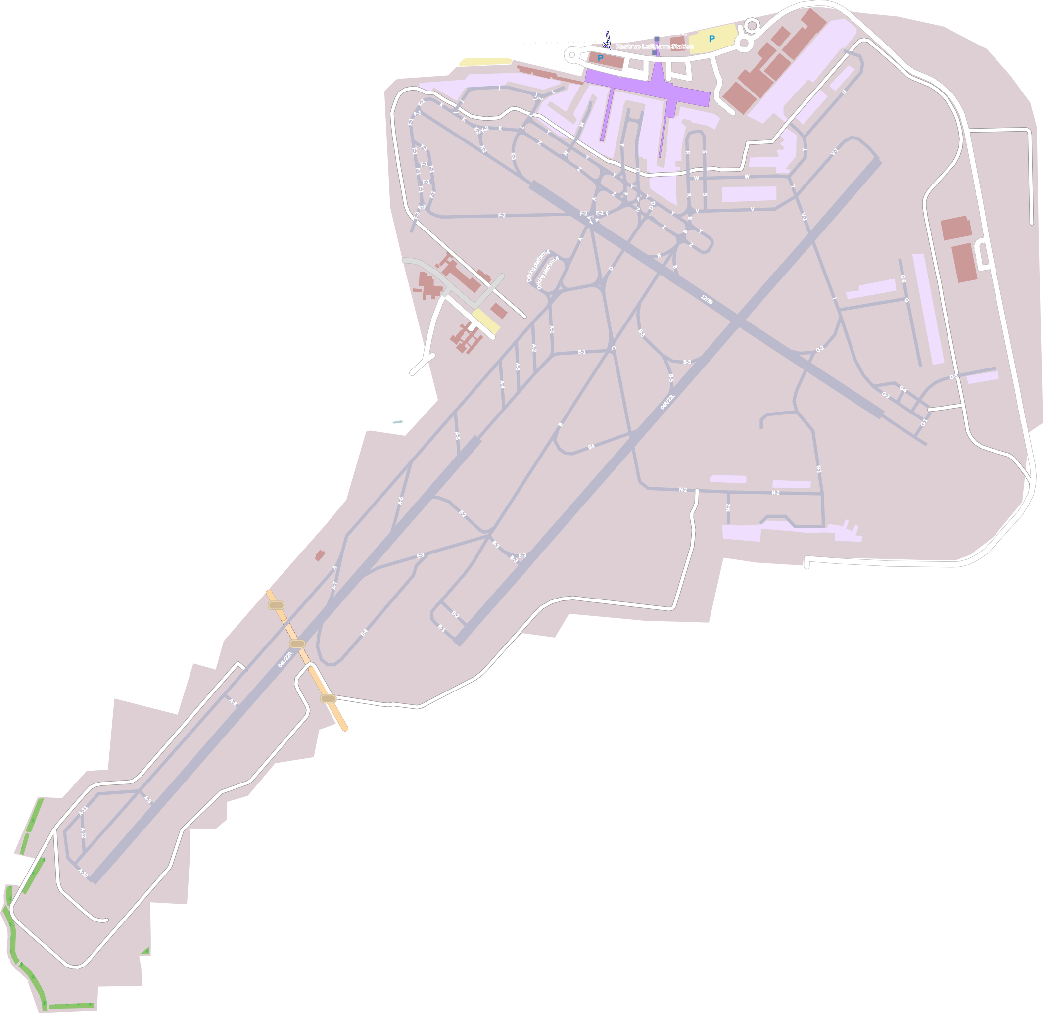
English: Map of Copenhagen Airport, Kastrup |
| Date | |
| Source | www.openstreetmap.com |
| Author | Map-data from www.openstreetmap.com. Exported to SVG using the SVG export-function on www.openstreetmap.com. The box was limited by the following lines: North=55.6341 East=12.6828 South=55.5856 West=12.5937. The scale was 1:17500. All superflourus data was manually removed by me. |
| Permission (Reusing this file) |
All OpenStreetMap data and maps are Creative Commons "CC-BY-SA 2.0" licensed |
| SVG development |

| Object location | | View this and other nearby images on: OpenStreetMap |
|---|
Licensing
This file is licensed under the Creative Commons Attribution-Share Alike 2.0 Generic license.
- You are free:
- to share – to copy, distribute and transmit the work
- to remix – to adapt the work
- Under the following conditions:
- attribution – You must give appropriate credit, provide a link to the license, and indicate if changes were made. You may do so in any reasonable manner, but not in any way that suggests the licensor endorses you or your use.
- share alike – If you remix, transform, or build upon the material, you must distribute your contributions under the same or compatible license as the original.
File history
Click on a date/time to view the file as it appeared at that time.
| Date/Time | Dimensions | User | Comment | |
|---|---|---|---|---|
| current | 08:09, 20 April 2009 | 2,152 × 2,091 (627 KB) | Heb | == Summary == {{Information |Description={{en|Map of Copenhagen Airport, Kastrup}} |Source=[http://www.openstreetmap.com/ www.openstreetmap.com] |Date=2009-04-20 (20 APR 2009) |Author=Map-data from [http://www.openstreetmap.com/ www.openstreetmap.com]. Ex |
File usage
The following page uses this file: