File:Cambodia - Sihanoukville Autonomous Port.jpg

Size of this preview: 800 × 533 pixels. Other resolutions: 320 × 213 pixels | 640 × 427 pixels | 1,024 × 683 pixels | 1,280 × 853 pixels | 5,184 × 3,456 pixels.
Original file (5,184 × 3,456 pixels, file size: 15.13 MB, MIME type: image/jpeg)
| This is a file from the Wikimedia Commons. The description on its description page there is shown below.
|
Summary
| Description |
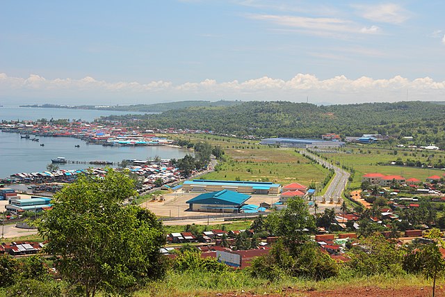
English: Sihanoukville Autonomous Port - Cambodia. Sihanoukville Port Special Economic Zone - SPSEZ
Español: Puerto Autónomo Sihanoukville - Camboya
ភាសាខ្មែរ: ខេត្តព្រះសីហនុ។ កំពង់ផែសមុទ្រ |
| Date | |
| Source | Own work |
| Author | Dmitry Makeev |
| Camera location | | View this and other nearby images on: OpenStreetMap |
|---|

| This image is not public domain. Please respect the copyright protection. It may only be used according to the rules mentioned here. This specifically excludes use in social media, if applicable terms of the licenses listed here not appropriate.
|

| Please do not upload an updated image here without consultation with the Author. The author would like to make corrections only at his own source. This ensures that the changes are preserved.
Please if you think that any changes should be required, please inform the author. Otherwise you can upload a new image with a new name. Please use one of the templates derivative or extract. |
Licensing
I, the copyright holder of this work, hereby publish it under the following license:
This file is licensed under the Creative Commons Attribution-Share Alike 4.0 International license.
- You are free:
- to share – to copy, distribute and transmit the work
- to remix – to adapt the work
- Under the following conditions:
- attribution – You must give appropriate credit, provide a link to the license, and indicate if changes were made. You may do so in any reasonable manner, but not in any way that suggests the licensor endorses you or your use.
- share alike – If you remix, transform, or build upon the material, you must distribute your contributions under the same or compatible license as the original.
| Annotations | This image is annotated: View the annotations at Commons |
This image has been assessed using the Quality image guidelines and is considered a Quality image.
|
File history
Click on a date/time to view the file as it appeared at that time.
| Date/Time | Dimensions | User | Comment | |
|---|---|---|---|---|
| current | 09:38, 19 April 2019 | 5,184 × 3,456 (15.13 MB) | Knopik-som | User created page with UploadWizard |
File usage
The following page uses this file: