File:Cowley Civil Parish Map 1868.svg

Size of this PNG preview of this SVG file: 535 × 600 pixels. Other resolutions: 214 × 240 pixels | 428 × 480 pixels | 685 × 768 pixels | 913 × 1,024 pixels | 645 × 723 pixels.
Original file (SVG file, nominally 645 × 723 pixels, file size: 214 KB)
| This is a file from the Wikimedia Commons. The description on its description page there is shown below.
|
Summary
| Description |
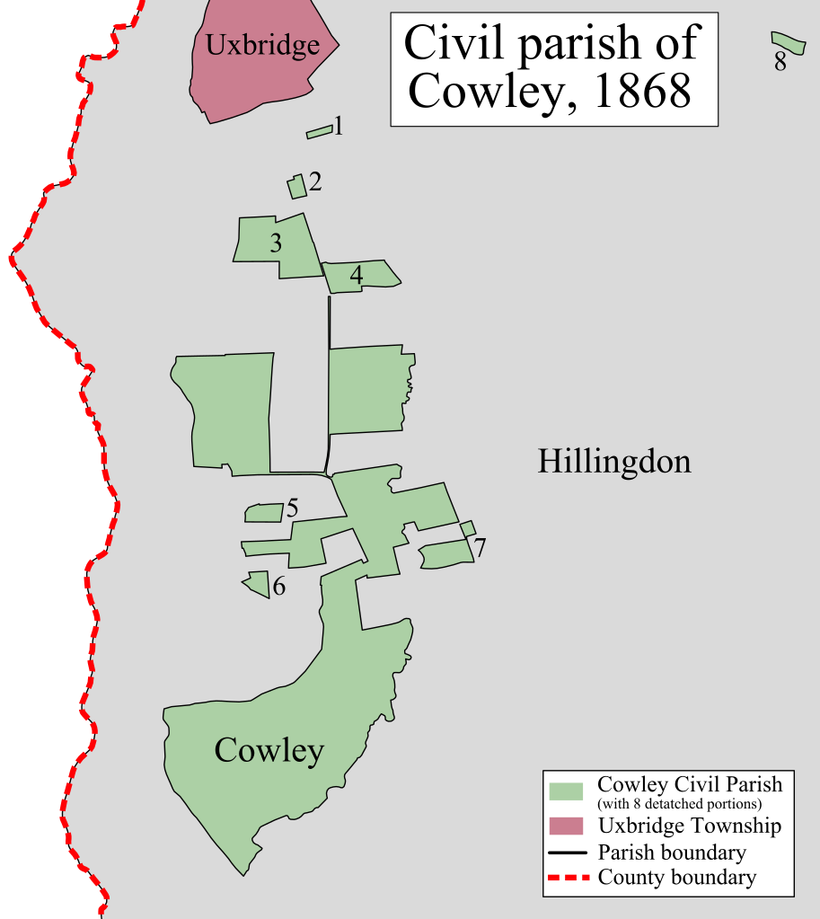
English: A map showing the civil parish of Cowley as it appeared in 1868. Based on the Ordnance Survey 'County Series' Map of Middlesex (1862-68) Sheet XIV at 1:10,560 scale.
Accessed at http://maps.nls.uk/index.html |
| Date | |
| Source | Own work |
| Author | Doc77can |
Licensing
I, the copyright holder of this work, hereby publish it under the following license:
This file is licensed under the Creative Commons Attribution-Share Alike 4.0 International license.
- You are free:
- to share – to copy, distribute and transmit the work
- to remix – to adapt the work
- Under the following conditions:
- attribution – You must give appropriate credit, provide a link to the license, and indicate if changes were made. You may do so in any reasonable manner, but not in any way that suggests the licensor endorses you or your use.
- share alike – If you remix, transform, or build upon the material, you must distribute your contributions under the same or compatible license as the original.
File history
Click on a date/time to view the file as it appeared at that time.
| Date/Time | Dimensions | User | Comment | |
|---|---|---|---|---|
| current | 11:43, 25 January 2015 | 645 × 723 (214 KB) | Doc77can | User created page with UploadWizard |
File usage
The following page uses this file: