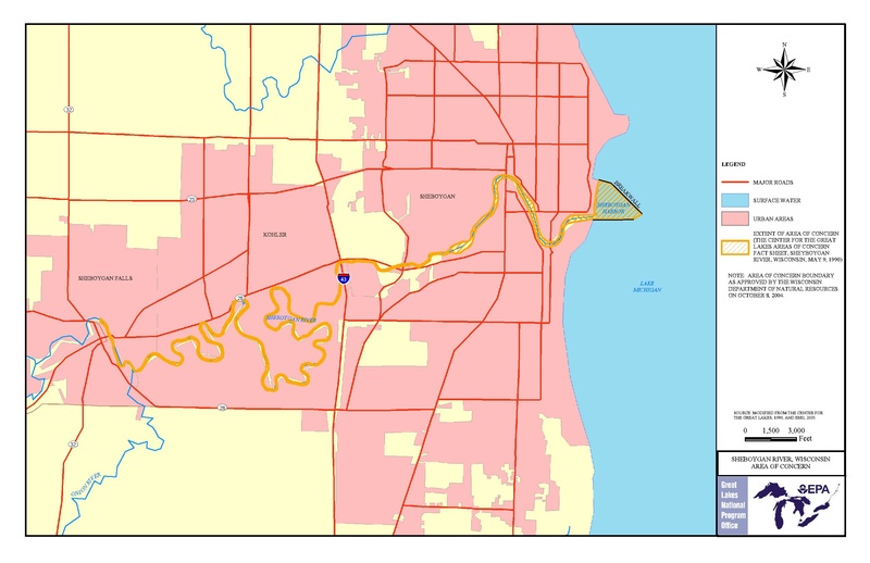
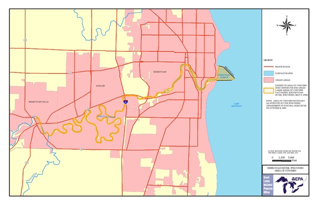
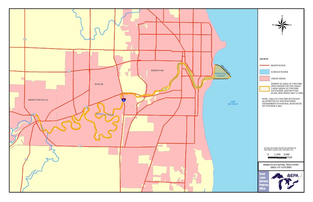
File:EPA map of the Sheboygan River - final state approved.pdf
Size of this JPG preview of this PDF file: 800 × 518 pixels. Other resolutions: 320 × 207 pixels | 640 × 414 pixels | 1,024 × 663 pixels | 1,280 × 828 pixels | 2,550 × 1,650 pixels.
Original file (2,550 × 1,650 pixels, file size: 468 KB, MIME type: application/pdf)
| This is a file from the Wikimedia Commons. The description on its description page there is shown below.
|
| Description | EPA map of the Sheboygan River. | |||||
| Source | https://www.epa.gov/sheboygan-river-aoc/sheboygan-river-aoc-boundary-map | |||||
| Author | EPA | |||||
| Permission (Reusing this file) |
|
File history
Click on a date/time to view the file as it appeared at that time.
| Date/Time | Dimensions | User | Comment | |
|---|---|---|---|---|
| current | 12:56, 15 August 2016 | 2,550 × 1,650 (468 KB) | Geo Swan | {{Information |Description=EPA map of the Sheboygan River. |Source=https://www.epa.gov/sheboygan-river-aoc/sheboygan-river-aoc-boundary-map |Date= |Author= EPA |Permission={{PD-USGov-EPA}} |other_versions= }} Category:Sheboygan River |
File usage
The following page uses this file: