File:Eau Rouge01.jpg
Size of this preview: 800 × 600 pixels. Other resolutions: 320 × 240 pixels | 640 × 480 pixels | 1,024 × 768 pixels | 1,280 × 960 pixels | 2,592 × 1,944 pixels.
Original file (2,592 × 1,944 pixels, file size: 1.3 MB, MIME type: image/jpeg)
| This is a file from the Wikimedia Commons. The description on its description page there is shown below.
|
Summary
| Camera location | | View this and other nearby images on: OpenStreetMap |
|---|
| Description |
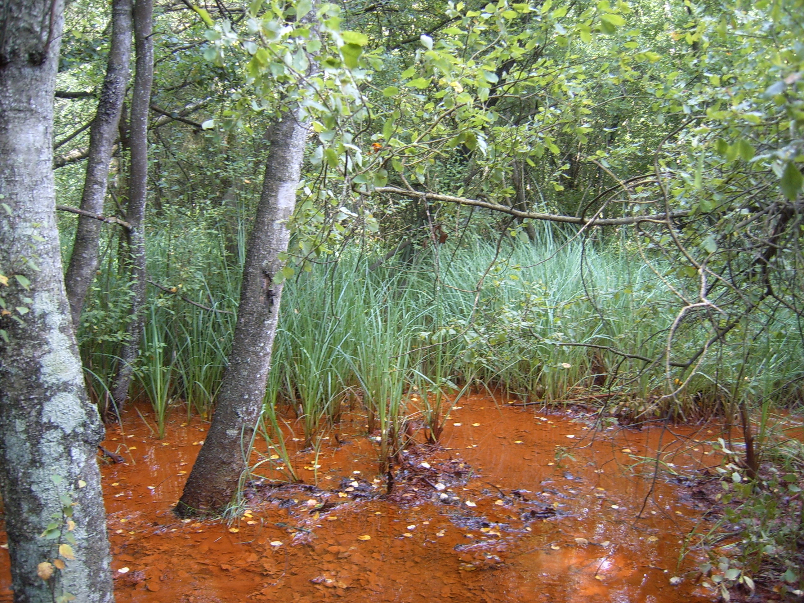
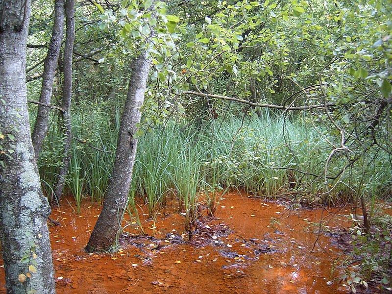
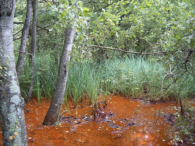
English: Swamp close to the Eau Rouge river ("Red water", because of its high iron concentration). The circuit de Spa-Francorchamps is about 1km lower.
Français : Marécage au fr:Pouhon de Bernister sur les rives de l'fr:Eau Rouge saturée en fr:fer. Le fr:circuit de Spa-Francorchamps se trouve à environ 1km vers l'aval |
||
| Date | |||
| Source | Own work | ||
| Author | Utilisateur:Bel Adone | ||
| Permission (Reusing this file) |
|
Licensing
| I, the copyright holder of this work, release this work into the public domain. This applies worldwide. In some countries this may not be legally possible; if so: I grant anyone the right to use this work for any purpose, without any conditions, unless such conditions are required by law. |
File history
Click on a date/time to view the file as it appeared at that time.
| Date/Time | Dimensions | User | Comment | |
|---|---|---|---|---|
| current | 12:51, 1 March 2011 | 2,592 × 1,944 (1.3 MB) | Vberger~commonswiki | {{Information |Description ={{en|1=fg}} |Source ={{own}} |Author =Vberger |Date = |Permission = |other_versions = }} fdg |
File usage
The following page uses this file: