File:Ecuador-peru-land-claims-01.png
Size of this preview: 800 × 585 pixels. Other resolutions: 320 × 234 pixels | 640 × 468 pixels | 1,000 × 731 pixels.
Original file (1,000 × 731 pixels, file size: 188 KB, MIME type: image/png)
| This is a file from the Wikimedia Commons. The description on its description page there is shown below.
|
Summary
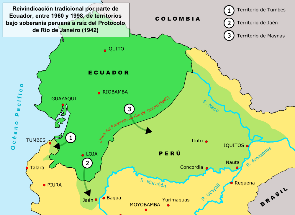
| Description | Map showing ecuadorean territorial claims on Peru (in Spanish) |
| Date | |
| Source | Own work |
| Author | Haylli |
| Permission (Reusing this file) |
This image is released by its author under the GNU Free Documentation License |
Licensing
I, the copyright holder of this work, hereby publish it under the following licenses:

|
Permission is granted to copy, distribute and/or modify this document under the terms of the GNU Free Documentation License, Version 1.2 or any later version published by the Free Software Foundation; with no Invariant Sections, no Front-Cover Texts, and no Back-Cover Texts. A copy of the license is included in the section entitled GNU Free Documentation License. |
| This file is licensed under the Creative Commons Attribution-Share Alike 3.0 Unported license. | ||
| ||
| This licensing tag was added to this file as part of the GFDL licensing update. |
You may select the license of your choice.
File history
Click on a date/time to view the file as it appeared at that time.
| Date/Time | Dimensions | User | Comment | |
|---|---|---|---|---|
| current | 08:52, 3 June 2006 | 1,000 × 731 (188 KB) | Haylli | {{Information |Description=Map showing ecuadorean territorial claims on Peru (in Spanish) |Source=own work |Date=June 2006 |Author=User:Haylli |Permission=This image is released by its author under the GNU Free Documentation License |other_versions= |
File usage
The following page uses this file: