File:Episcopal Church of the Good Shepherd (1915) Wichita Falls.jpg

Size of this preview: 800 × 533 pixels. Other resolutions: 320 × 213 pixels | 640 × 427 pixels | 1,024 × 683 pixels | 1,280 × 853 pixels | 3,456 × 2,304 pixels.
Original file (3,456 × 2,304 pixels, file size: 6.03 MB, MIME type: image/jpeg)
| This is a file from the Wikimedia Commons. The description on its description page there is shown below.
|
_Wichita_Falls.jpg)
Summary
| Description |
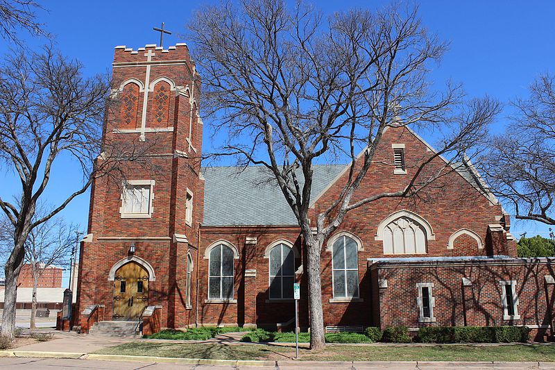
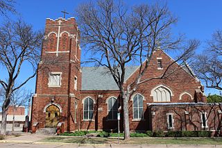
English: Episcopal Church of the Good Shepherd, built in 1915. Located at 1007 Burnett Street, Wichita Falls, Texas. |
| Date | 28 February 2016, 14:37:03 |
| Source | Own work |
| Author | © Travis K. Witt |
| Permission (Reusing this file) |
I, the copyright holder of this work, hereby publish it under the following license: This file is licensed under the Creative Commons Attribution-Share Alike 4.0 International license.
|
| Attribution (required by the license) | Preferred credits: Online: Photo: © Travis K. Witt, Licence: Creative Commons BY-SA 4.0, Source: Wikimedia Commons |
| Camera location | | View this and other nearby images on: OpenStreetMap |
|---|
_Wichita_Falls.jpg¶ms=033.907339_N_-098.494558_E_globe:Earth_type:camera__&language=en)
File history
Click on a date/time to view the file as it appeared at that time.
| Date/Time | Dimensions | User | Comment | |
|---|---|---|---|---|
| current | 17:32, 22 October 2016 | 3,456 × 2,304 (6.03 MB) | Liveon001 | User created page with UploadWizard |
File usage
The following page uses this file:
_Wichita_Falls.jpg)