File:Extrem north east algeria topographic map.jpg

Size of this preview: 712 × 599 pixels. Other resolutions: 285 × 240 pixels | 570 × 480 pixels | 713 × 600 pixels | 912 × 768 pixels | 1,216 × 1,024 pixels | 5,368 × 4,519 pixels.
Original file (5,368 × 4,519 pixels, file size: 7.35 MB, MIME type: image/jpeg)
| This is a file from the Wikimedia Commons. The description on its description page there is shown below.
|
Summary
| Description |
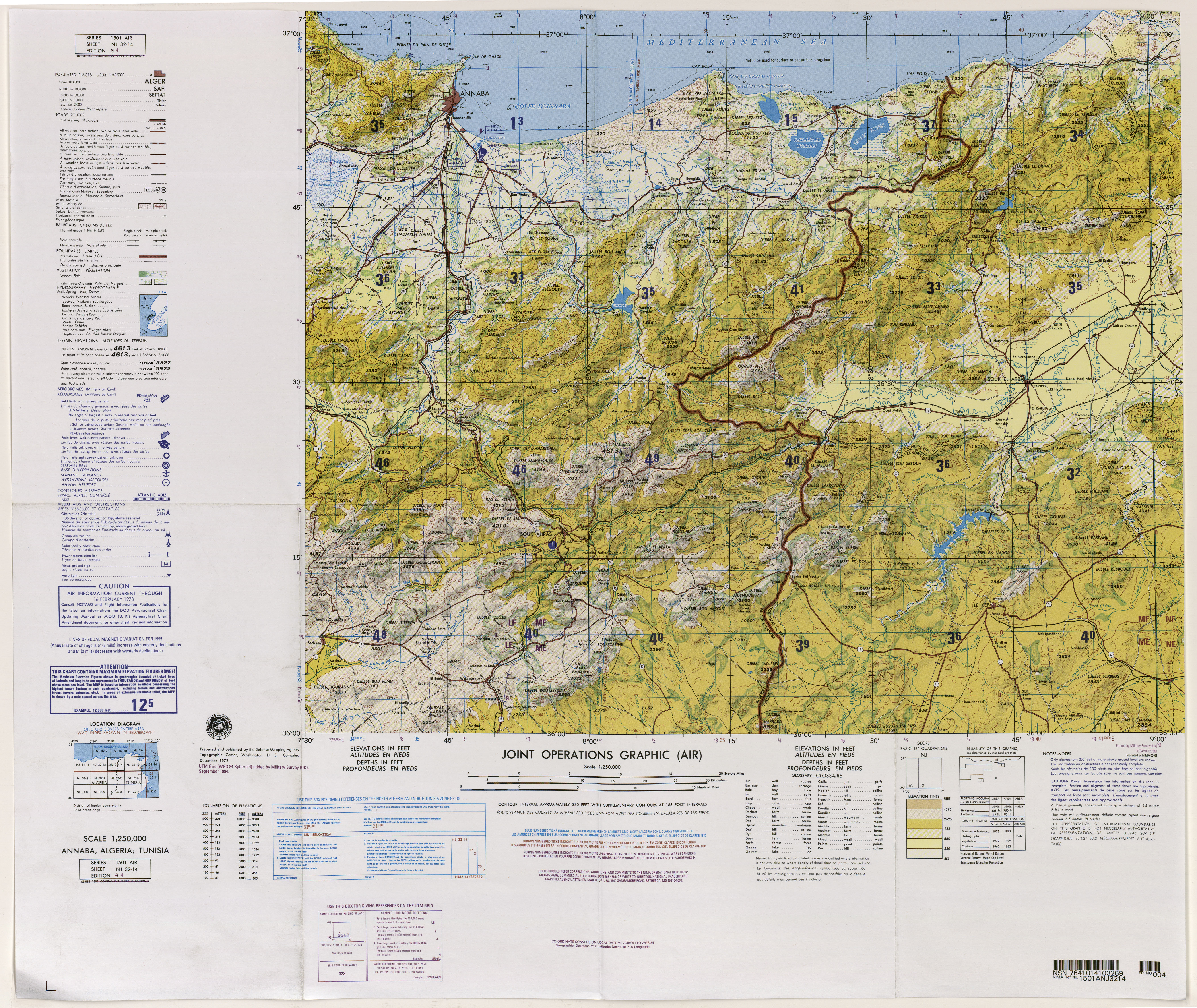
English: north east algeria topographic map |
| Date | Unknown date |
| Source | http://www.lib.utexas.edu/maps/jog/algeria_tunisia/txu-oclc-224106464-nj32-14.jpg |
| Author | Unknown author |
| Other versions | Derivative works of this file: Souk ahras topography.jpg |
Licensing
This file is a work of a U.S. Army soldier or employee, taken or made as part of that person's official duties. As a work of the U.S. federal government, it is in the public domain in the United States.
|
 |
File history
Click on a date/time to view the file as it appeared at that time.
| Date/Time | Dimensions | User | Comment | |
|---|---|---|---|---|
| current | 17:44, 7 August 2011 | 5,368 × 4,519 (7.35 MB) | Omar2788 | {{Information |Description ={{en|1=north east algeria topographic map}} |Source =http://www.lib.utexas.edu/maps/jog/algeria_tunisia/txu-oclc-224106464-nj32-14.jpg |Author =unknown |Date =unknown |Permission = |other_versio |
File usage
There are no pages that use this file.