File:Frankfurter Kreuz - BAB 3 und 5.jpg
Size of this preview: 758 × 600 pixels. Other resolutions: 303 × 240 pixels | 607 × 480 pixels | 971 × 768 pixels | 1,280 × 1,013 pixels | 3,073 × 2,432 pixels.
Original file (3,073 × 2,432 pixels, file size: 2.27 MB, MIME type: image/jpeg)
This is a file from the Wikimedia Commons. The description on its description page there is shown below.
|
Summary
DescriptionFrankfurter Kreuz - BAB 3 und 5.jpg |
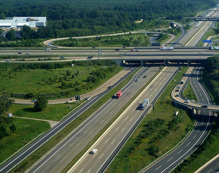
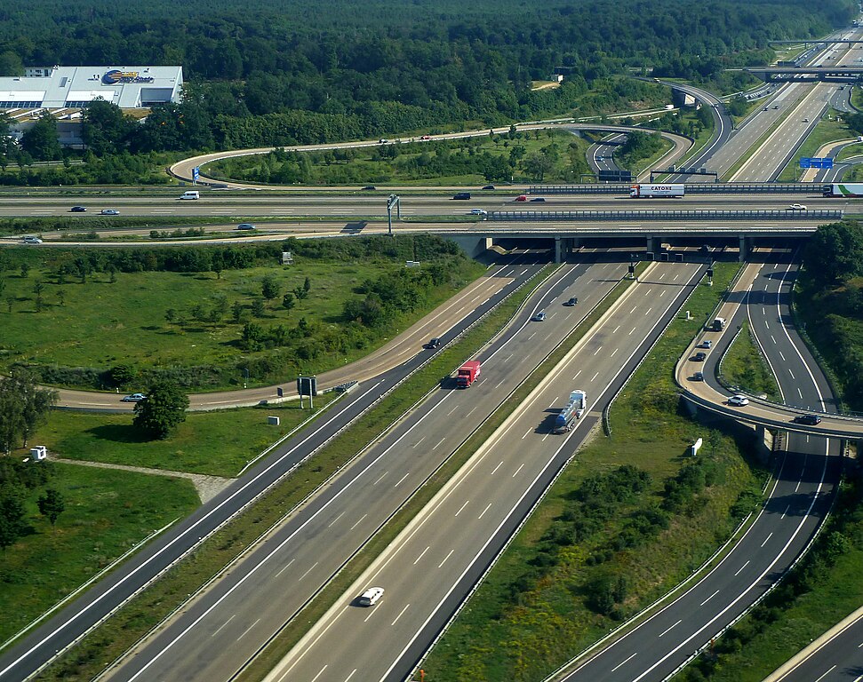
English: Autobahn A5 in Frankfurt |
Date | |
Source | https://www.flickr.com/photos/bezrukov/6069942071 |
Author | Vladislav Bezrukov |
Object location | 50° 03′ 10.51″ N, 8° 36′ 07.27″ E | View this and other nearby images on: OpenStreetMap | 50.052920; 8.602020 |
---|
Camera location | 50° 02′ 24″ N, 8° 36′ 36″ E | View this and other nearby images on: OpenStreetMap | 50.040000; 8.610000 |
---|
This is a retouched picture, which means that it has been digitally altered from its original version. Modifications: cropped image. The original can be viewed here: Landing in Frankfurt - Autobahn A5.jpg: . Modifications made by John-vogel.
|
Licensing
This image, originally posted to Flickr, was reviewed on 6 November 2012 by the administrator or reviewer Morning Sunshine, who confirmed that it was available on Flickr under the stated license on that date. |
This file is licensed under the Creative Commons Attribution 2.0 Generic license.
- You are free:
- to share – to copy, distribute and transmit the work
- to remix – to adapt the work
- Under the following conditions:
- attribution – You must give appropriate credit, provide a link to the license, and indicate if changes were made. You may do so in any reasonable manner, but not in any way that suggests the licensor endorses you or your use.
Items portrayed in this file
depicts
some value
2 July 2011
50°2'24.000"N, 8°36'36.000"E
0.003125 second
7.3 millimetre
image/jpeg
50°3'10.512"N, 8°36'7.272"E
File history
Click on a date/time to view the file as it appeared at that time.
Date/Time | Dimensions | User | Comment | |
---|---|---|---|---|
current | 03:06, 6 November 2012 | 3,073 × 2,432 (2.27 MB) | Fundatus | User created page with UploadWizard |
File usage
The following page uses this file:
Metadata
This file contains additional information, probably added from the digital camera or scanner used to create or digitize it.
If the file has been modified from its original state, some details may not fully reflect the modified file.
Camera manufacturer | Panasonic |
---|---|
Camera model | DMC-TZ10 |
Exposure time | 1/320 sec (0.003125) |
F Number | f/4 |
ISO speed rating | 80 |
Date and time of data generation | 08:16, 2 July 2011 |
Lens focal length | 7.3 mm |
Latitude | 26° 13′ 59.83″ N |
Longitude | 50° 32′ 4.03″ E |
Width | 4,000 px |
Height | 3,000 px |
Bits per component |
|
Pixel composition | RGB |
Orientation | Normal |
Number of components | 3 |
Horizontal resolution | 180 dpi |
Vertical resolution | 180 dpi |
Software used | Adobe Photoshop CS6 (Windows) |
File change date and time | 22:58, 6 November 2012 |
Y and C positioning | Co-sited |
Exposure Program | Normal program |
Exif version | 2.21 |
Date and time of digitizing | 08:16, 2 July 2011 |
Meaning of each component |
|
Image compression mode | 4 |
APEX shutter speed | 8.321928 |
APEX aperture | 4 |
APEX exposure bias | 0 |
Maximum land aperture | 3.44 APEX (f/3.29) |
Metering mode | Pattern |
Light source | Unknown |
Flash | Flash did not fire, compulsory flash suppression |
Supported Flashpix version | 1 |
Color space | sRGB |
Sensing method | One-chip color area sensor |
File source | Digital still camera |
Scene type | A directly photographed image |
Custom image processing | Normal process |
Exposure mode | Auto exposure |
White balance | Auto white balance |
Digital zoom ratio | 0 |
Focal length in 35 mm film | 44 mm |
Scene capture type | Standard |
Scene control | None |
Contrast | Normal |
Saturation | Normal |
Sharpness | Normal |
GPS time (atomic clock) | 06:35 |
Satellites used for measurement | 5 |
Receiver status | Measurement in progress |
Measurement mode | 2-dimensional measurement |
Measurement precision | Poor (2.6) |
Geodetic survey data used | WGS-84 |
GPS date | 30 June 2011 |
GPS tag version | 0.0.2.2 |
Date metadata was last modified | 11:58, 7 November 2012 |
Unique ID of original document | 3173EE8550E6A360D4A99BA7637DA656 |
IIM version | 6,776 |