File:Havelland FHSW.gif
Size of this preview: 795 × 600 pixels. Other resolutions: 318 × 240 pixels | 636 × 480 pixels | 1,018 × 768 pixels | 1,035 × 781 pixels.
Original file (1,035 × 781 pixels, file size: 129 KB, MIME type: image/gif)
| This is a file from the Wikimedia Commons. The description on its description page there is shown below.
|
Summary
| Description |
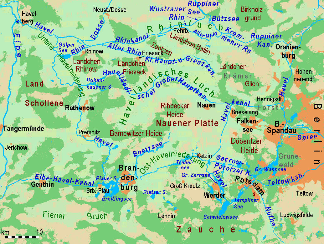
Deutsch: Gliederung und Gewässernetz des Havellandes English: Partition and waterways of Havelland region west of Berlin |
| Source | http://www.maps-for-free |
| Author | Ulamm 17:33, 28 February 2008 (UTC) |
| Other versions |
Image:Havelland FHSW.gif English: relief and waterbodies only Deutsch: Basis: Relief und Gewässer Image:Luche FHSW.gif English: Cut: Wetlands called "Luch" Deutsch: Ausschnitt: Havelländisches Luch und Rhinluch |
Licensing
This file is licensed under the Creative Commons Attribution-Share Alike 3.0 Unported license.
- You are free:
- to share – to copy, distribute and transmit the work
- to remix – to adapt the work
- Under the following conditions:
- attribution – You must give appropriate credit, provide a link to the license, and indicate if changes were made. You may do so in any reasonable manner, but not in any way that suggests the licensor endorses you or your use.
- share alike – If you remix, transform, or build upon the material, you must distribute your contributions under the same or compatible license as the original.
File history
Click on a date/time to view the file as it appeared at that time.
| Date/Time | Dimensions | User | Comment | |
|---|---|---|---|---|
| current | 04:09, 6 April 2008 | 1,035 × 781 (129 KB) | Ulamm | {{Information |Description= |Source= |Date= |Author= |Permission= |other_versions= }} |
File usage
The following page uses this file: