File:Jian'an Commanderies.png
Size of this preview: 800 × 576 pixels. Other resolutions: 320 × 230 pixels | 640 × 461 pixels | 1,024 × 737 pixels | 1,280 × 922 pixels | 2,500 × 1,800 pixels.
Original file (2,500 × 1,800 pixels, file size: 5.28 MB, MIME type: image/png)
| This is a file from the Wikimedia Commons. The description on its description page there is shown below.
|
Summary

|
File:Jian'an Commanderies.svg is a vector version of this file. It should be used in place of this PNG file when not inferior.
File:Jian'an Commanderies.png → File:Jian'an Commanderies.svg
For more information, see Help:SVG. |
 |
| Description |
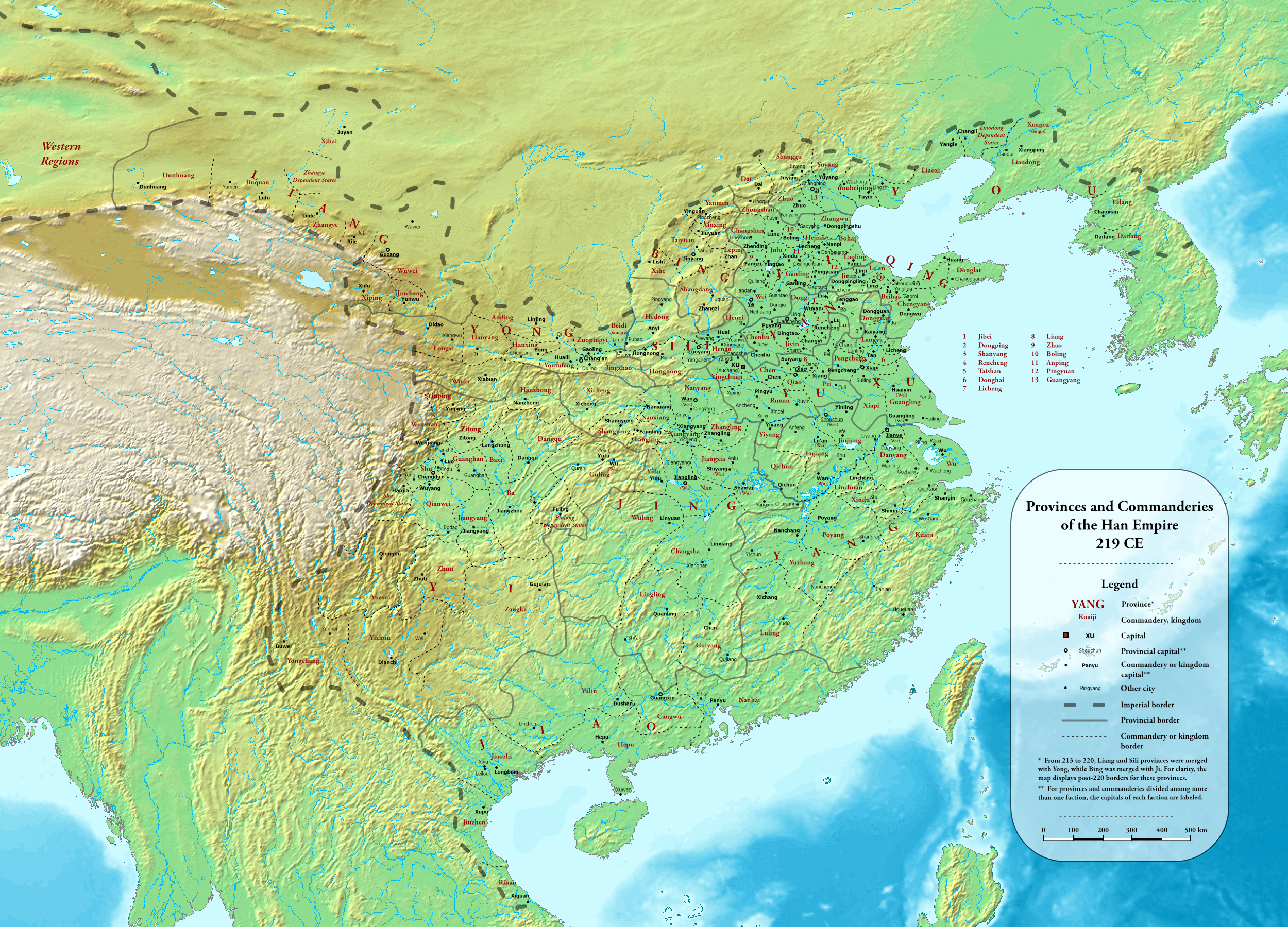
English: Provinces and commanderies of the Han Dynasty in 219 CE, during the Jian'an era
中文(简体):东汉建安时期州郡地图(建安二十四年,公元219年) |
| Date | |
| Source |
Own work using:
|
| Author | Esiymbro |
Licensing
I, the copyright holder of this work, hereby publish it under the following license:
This file is licensed under the Creative Commons Attribution-Share Alike 4.0 International license.
- You are free:
- to share – to copy, distribute and transmit the work
- to remix – to adapt the work
- Under the following conditions:
- attribution – You must give appropriate credit, provide a link to the license, and indicate if changes were made. You may do so in any reasonable manner, but not in any way that suggests the licensor endorses you or your use.
- share alike – If you remix, transform, or build upon the material, you must distribute your contributions under the same or compatible license as the original.
File history
Click on a date/time to view the file as it appeared at that time.
| Date/Time | Dimensions | User | Comment | |
|---|---|---|---|---|
| current | 18:54, 19 May 2022 | 2,500 × 1,800 (5.28 MB) | Esiymbro | Corrections and more details |
File usage
The following page uses this file: