File:Junction of the Yukon and Koyukuk Rivers, Alaska.jpg

Size of this preview: 704 × 600 pixels. Other resolutions: 282 × 240 pixels | 564 × 480 pixels | 902 × 768 pixels | 1,202 × 1,024 pixels | 3,177 × 2,706 pixels.
Original file (3,177 × 2,706 pixels, file size: 5.96 MB, MIME type: image/jpeg)
| This is a file from the Wikimedia Commons. The description on its description page there is shown below.
|
| Description |
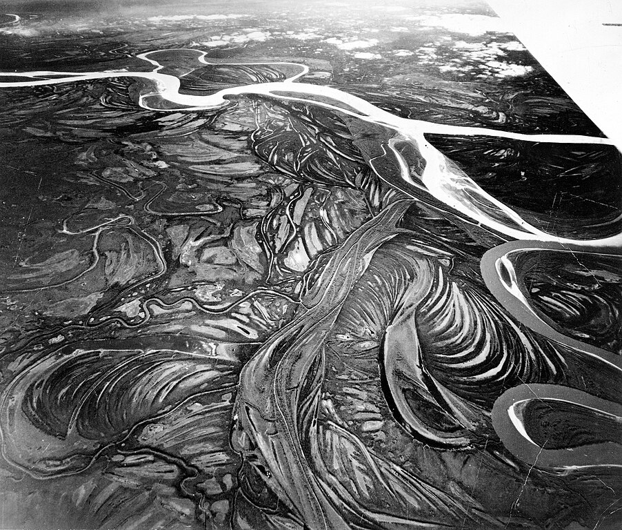
English: Alaska. High-altitude oblique aerial photograph looking south toward the junction of the Yukon and Koyukuk Rivers. The Koyukuk River (dark color) joins the silt-laden Yukon River (light color) at the right. (Aircraft wing visible at upper right corner of image.) |
|||
| Date | ||||
| Source | ptl00849.jpg in the USGS Denver Library Photographic Collection, USGS ScienceBase Catalog. This photograph appears as fig. 35 on p. 65 in: Troy Lewis Pewe (1975): Quaternary geology of Alaska. USGS Professional Paper 835 (download page) | |||
| Author | According to the caption in Pewe (1975) the photograph was taken by the U.S. Army Air Corps | |||
| Permission (Reusing this file) |
|
File history
Click on a date/time to view the file as it appeared at that time.
| Date/Time | Dimensions | User | Comment | |
|---|---|---|---|---|
| current | 13:45, 18 September 2017 | 3,177 × 2,706 (5.96 MB) | Gretarsson | Upload of much larger version from USGS ScienceBase Catalog, reduced in size by 25% without information loss because the original file (9 MB) is somewhat blurry |
File usage
The following page uses this file: