File:KYphysiography.jpg

Size of this preview: 800 × 353 pixels. Other resolutions: 320 × 141 pixels | 824 × 364 pixels.
Original file (824 × 364 pixels, file size: 159 KB, MIME type: image/jpeg)
| This is a file from the Wikimedia Commons. The description on its description page there is shown below.
|

|
This map image could be re-created using vector graphics as an SVG file. This has several advantages; see Commons:Media for cleanup for more information. If an SVG form of this image is available, please upload it and afterwards replace this template with
{{vector version available|new image name}}.
It is recommended to name the SVG file “KYphysiography.svg”—then the template Vector version available (or Vva) does not need the new image name parameter. |


Summary
| Description |
English: I created this image using Wikipedia's map of Kentucky counties.
|
| Date | 1 May 2007 (original upload date) |
| Source | Transferred from en.wikipedia to Commons by byankno1. |
| Author | Lamontacranston at English Wikipedia |
Licensing
| This work has been released into the public domain by its author, Lamontacranston at English Wikipedia. This applies worldwide. In some countries this may not be legally possible; if so: Lamontacranston grants anyone the right to use this work for any purpose, without any conditions, unless such conditions are required by law. |
Original upload log
The original description page was here. All following user names refer to en.wikipedia.
- 2007-05-01 00:01 Lamontacranston 824×364× (162592 bytes) Bigger fonts. I created this image.
- 2007-04-30 23:54 Lamontacranston 824×364× (154693 bytes) Added text, improved edges, slightly lightened colors. I created the original.
- 2006-09-09 19:16 Lamontacranston 824×364× (55286 bytes) I created this image using Wikipedia's map of Kentucky counties.
File history
Click on a date/time to view the file as it appeared at that time.
| Date/Time | Dimensions | User | Comment | |
|---|---|---|---|---|
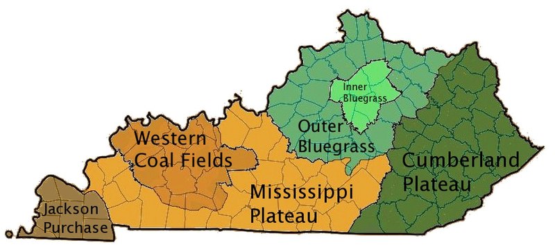
| current | 09:36, 18 November 2008 | 824 × 364 (159 KB) | EpcotMagic | {{Information |Description={{en|I created this image using Wikipedia's map of Kentucky counties. *Dark green - Eastern Kentucky Coal fields (Cumberland Plateau) *Green - Outer Bluegrass *Light Green - Inner Bluegrass *Light Brown - Mississippi (Pennyroyal |
File usage
The following page uses this file: