File:Karta över Tyskland år 1919 enligt Versaillesfreden (ur Nordisk familjebok).jpg

Size of this preview: 800 × 586 pixels. Other resolutions: 320 × 234 pixels | 640 × 469 pixels | 1,024 × 750 pixels | 1,280 × 937 pixels | 3,480 × 2,548 pixels.
Original file (3,480 × 2,548 pixels, file size: 1.05 MB, MIME type: image/jpeg)
| This is a file from the Wikimedia Commons. The description on its description page there is shown below.
|
.jpg)
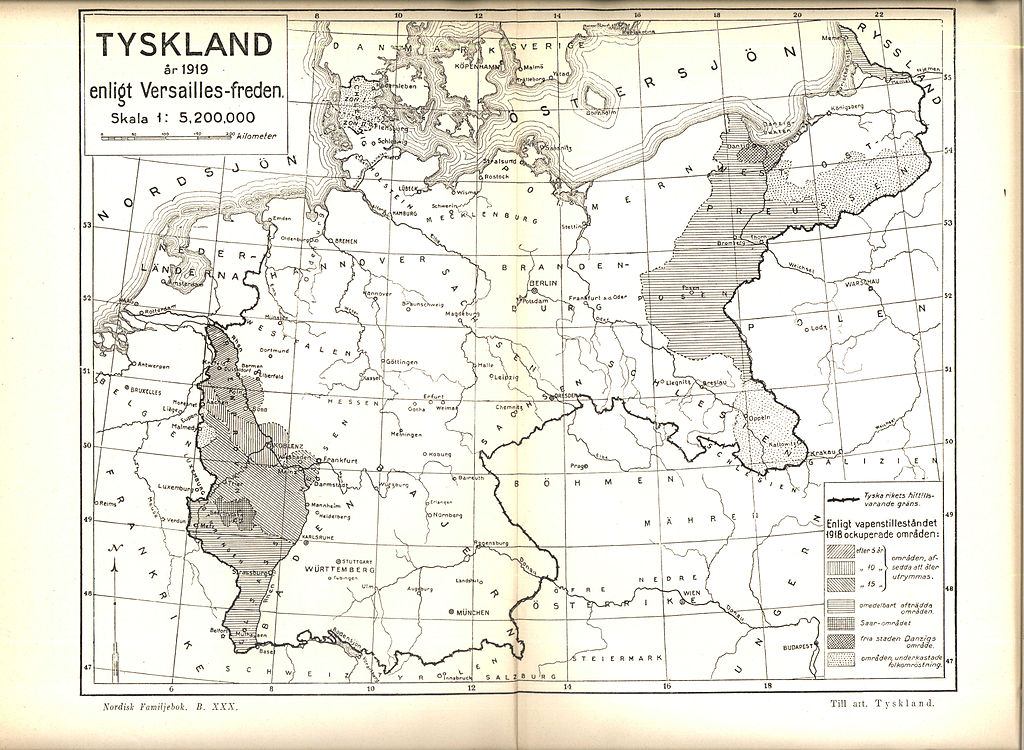
Alemannisch: Ditschland 1919 noch dr Bstimmige vum Versailler Vetrag
English: Map of Germany 1919 according to the Versailles treaty
Svenska: Karta över Tyskland år 1919 enligt Versaillesfreden
- Source: Nordisk familjebok
This image was first published in the 1st (1876–1899), 2nd (1904–1926) or 3rd (1923–1937) edition of Nordisk familjebok. The copyrights for that book have expired and this image is in the public domain, because images had no named authors and the book was published more than 70 years ago.
|
This image (or other media file) is in the public domain because its copyright has expired and its author is anonymous.
This applies to the European Union and those countries with a copyright term of 70 years after the work was made available to the public and the author never disclosed their identity. Important: Always mention where the image comes from, as far as possible, and make sure the author never claimed authorship. |
 | |
 |
Note: In Germany and possibly other countries, certain anonymous works published before July 1, 1995 are copyrighted until 70 years after the death of the author. See Übergangsrecht. Please use this template only if the author never claimed authorship or their authorship never became public in any other way. If the work is anonymous or pseudonymous (e.g., published only under a corporate or organization's name), use this template for images published more than 70 years ago.
For a work made available to the public in the United Kingdom, please use Template:PD-UK-unknown instead.
|
File history
Click on a date/time to view the file as it appeared at that time.
| Date/Time | Dimensions | User | Comment | |
|---|---|---|---|---|
| current | 16:10, 24 April 2005 | 3,480 × 2,548 (1.05 MB) | Den fjättrade ankan~commonswiki | *{{Svenska}} Karta över Tyskland år 1919 enligt Versaillesfreden *{{English}} Map of Germany 1919 according to the Versailles treaty *Source: Nordisk familjebok {{PD-Ugglan}} Category:History of Deutschland Category:Historical maps [[Category |
File usage
The following page uses this file:
.jpg)