File:Karte-Hohenzollern.png
Size of this preview: 782 × 600 pixels. Other resolutions: 313 × 240 pixels | 626 × 480 pixels | 1,002 × 768 pixels | 1,274 × 977 pixels.
Original file (1,274 × 977 pixels, file size: 59 KB, MIME type: image/png)
| This is a file from the Wikimedia Commons. The description on its description page there is shown below.
|
| Description |
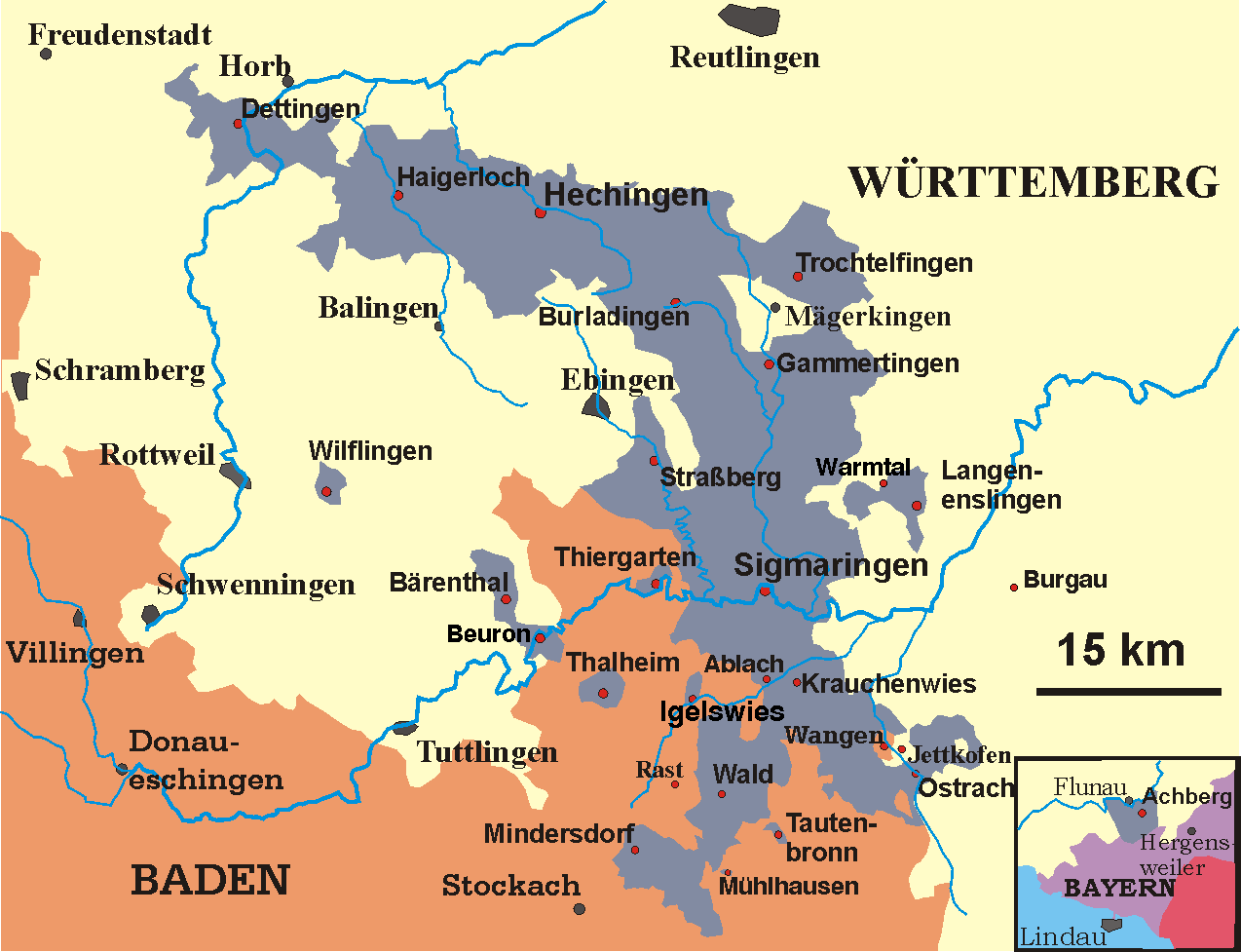
Deutsch: Karte der Hohenzollernschen Lande, Stand 1930
English: Map of the Prussian province of Hohenzollern, 1930 |
||
| Date | May 2005-December 2006 | ||
| Source | transferred from the German Wikipedia | ||
| Author | Störfix (original author), Ssch (modifications) | ||
| Permission (Reusing this file) |
|
File history
Click on a date/time to view the file as it appeared at that time.
| Date/Time | Dimensions | User | Comment | |
|---|---|---|---|---|
| current | 23:37, 30 September 2009 | 1,274 × 977 (59 KB) | Quartl | use brighter shade of blue to make texts better readable |
File usage
The following page uses this file: