File:Land Grant Colleges Map.svg

Size of this PNG preview of this SVG file: 776 × 600 pixels. Other resolutions: 311 × 240 pixels | 621 × 480 pixels | 994 × 768 pixels | 1,280 × 989 pixels | 990 × 765 pixels.
Original file (SVG file, nominally 990 × 765 pixels, file size: 447 KB)
| This is a file from the Wikimedia Commons. The description on its description page there is shown below.
|
Summary
| Description |
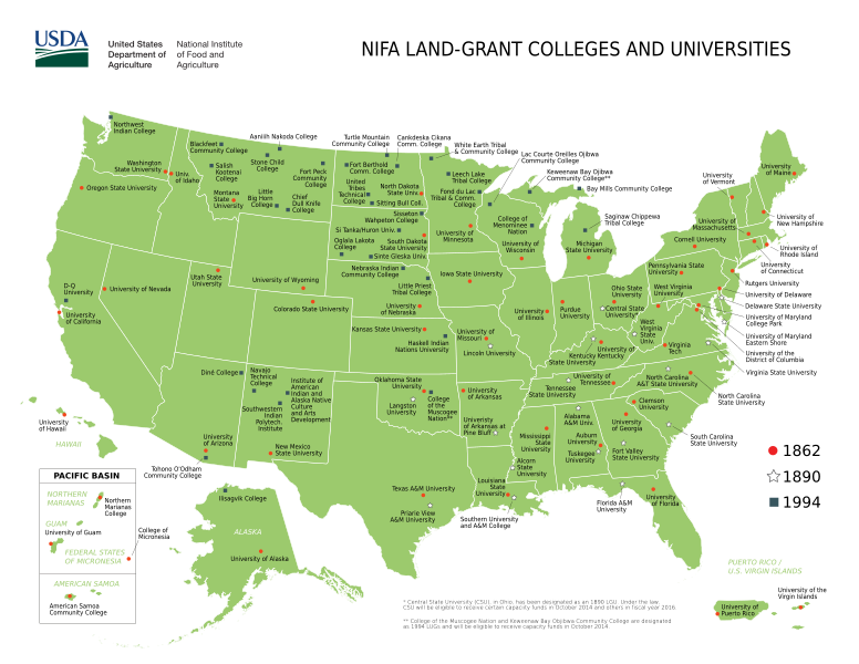
English: USDA NIFA map of United States land-grant universities and colleges. |
|||
| Date | ||||
| Source | https://nifa.usda.gov/sites/default/files/resource/lgu_map_6_25_2014_0.pdf | |||
| Author |
Original: USDA Vector: Cody Logan (aka clpo13) |
|||
| Other versions |
|
|||
| SVG development |


Licensing
This image or file is a work of a United States Department of Agriculture employee, taken or made as part of that person's official duties. As a work of the U.S. federal government, the image is in the public domain.
|
 |
File history
Click on a date/time to view the file as it appeared at that time.
| Date/Time | Dimensions | User | Comment | |
|---|---|---|---|---|
| current | 09:58, 17 April 2017 | 990 × 765 (447 KB) | Clpo13 | page size |
File usage
The following page uses this file: