File:Lanersbach.jpg
Size of this preview: 800 × 534 pixels. Other resolutions: 320 × 214 pixels | 640 × 427 pixels | 1,024 × 684 pixels | 1,280 × 855 pixels | 4,240 × 2,832 pixels.
Original file (4,240 × 2,832 pixels, file size: 5.34 MB, MIME type: image/jpeg)
| This is a file from the Wikimedia Commons. The description on its description page there is shown below.
|
Summary
![]() Austria
Austria ![]() Land Tirol
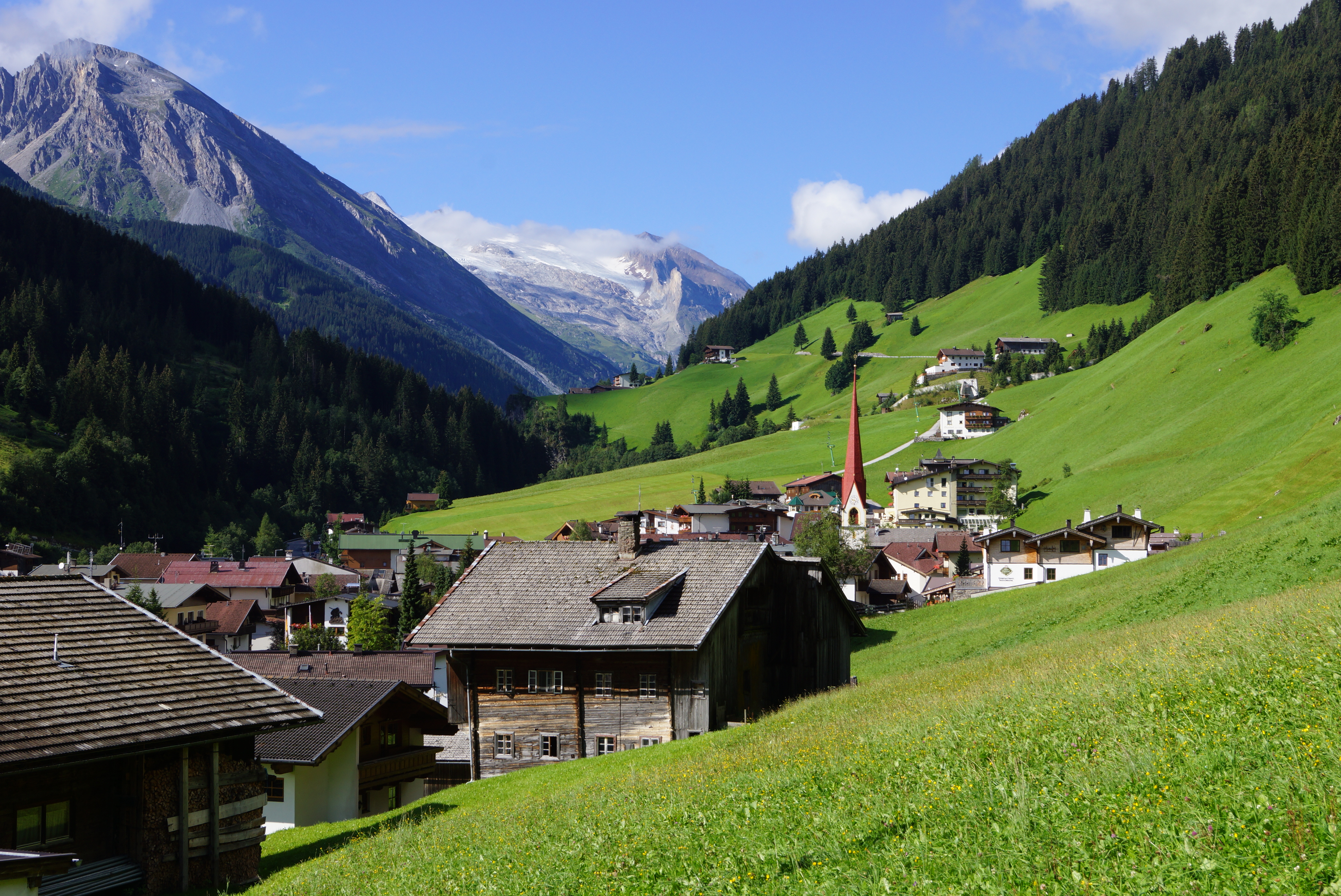
Land Tirol ![]() Tux - Tuxer Alpen 1.281 m ü. A.
Tux - Tuxer Alpen 1.281 m ü. A.
| Description |
Deutsch: Tuxertal: Wir schauen von Lanersbach (Ortsrand nahe Seilbahn-Talstation auf 1.290 m) talein in südwestlicher Richtung zum Hintertuxer Gletscher. Diese Talseite (orografisch links) gehört zu den Tuxer, die jenseitige zu den Zillertaler Alpen. |
| Date | Taken on 7 August 2012, 09:33:03 |
| Source | Own work |
| Author | FkMohr |
| Camera location | | View this and other nearby images on: OpenStreetMap |
|---|
T {BF120807-0933}
Licensing
Friedrich-Karl Mohr, the copyright holder of this work, hereby publishes it under the following license:
This file is licensed under the Creative Commons Attribution-Share Alike 3.0 Germany license.
Attribution: Friedrich-Karl Mohr
- You are free:
- to share – to copy, distribute and transmit the work
- to remix – to adapt the work
- Under the following conditions:
- attribution – You must give appropriate credit, provide a link to the license, and indicate if changes were made. You may do so in any reasonable manner, but not in any way that suggests the licensor endorses you or your use.
- share alike – If you remix, transform, or build upon the material, you must distribute your contributions under the same or compatible license as the original.

| Annotations | This image is annotated: View the annotations at Commons |
File history
Click on a date/time to view the file as it appeared at that time.
| Date/Time | Dimensions | User | Comment | |
|---|---|---|---|---|
| current | 12:37, 22 September 2012 | 4,240 × 2,832 (5.34 MB) | FkMohr | User created page with UploadWizard |
File usage
The following page uses this file: