File:Language distribution in South Tyrol and Trentino.png
Size of this preview: 774 × 600 pixels. Other resolutions: 310 × 240 pixels | 619 × 480 pixels | 991 × 768 pixels | 1,280 × 992 pixels | 2,000 × 1,550 pixels.
Original file (2,000 × 1,550 pixels, file size: 235 KB, MIME type: image/png)
| This is a file from the Wikimedia Commons. The description on its description page there is shown below.
|
Summary
| Description |
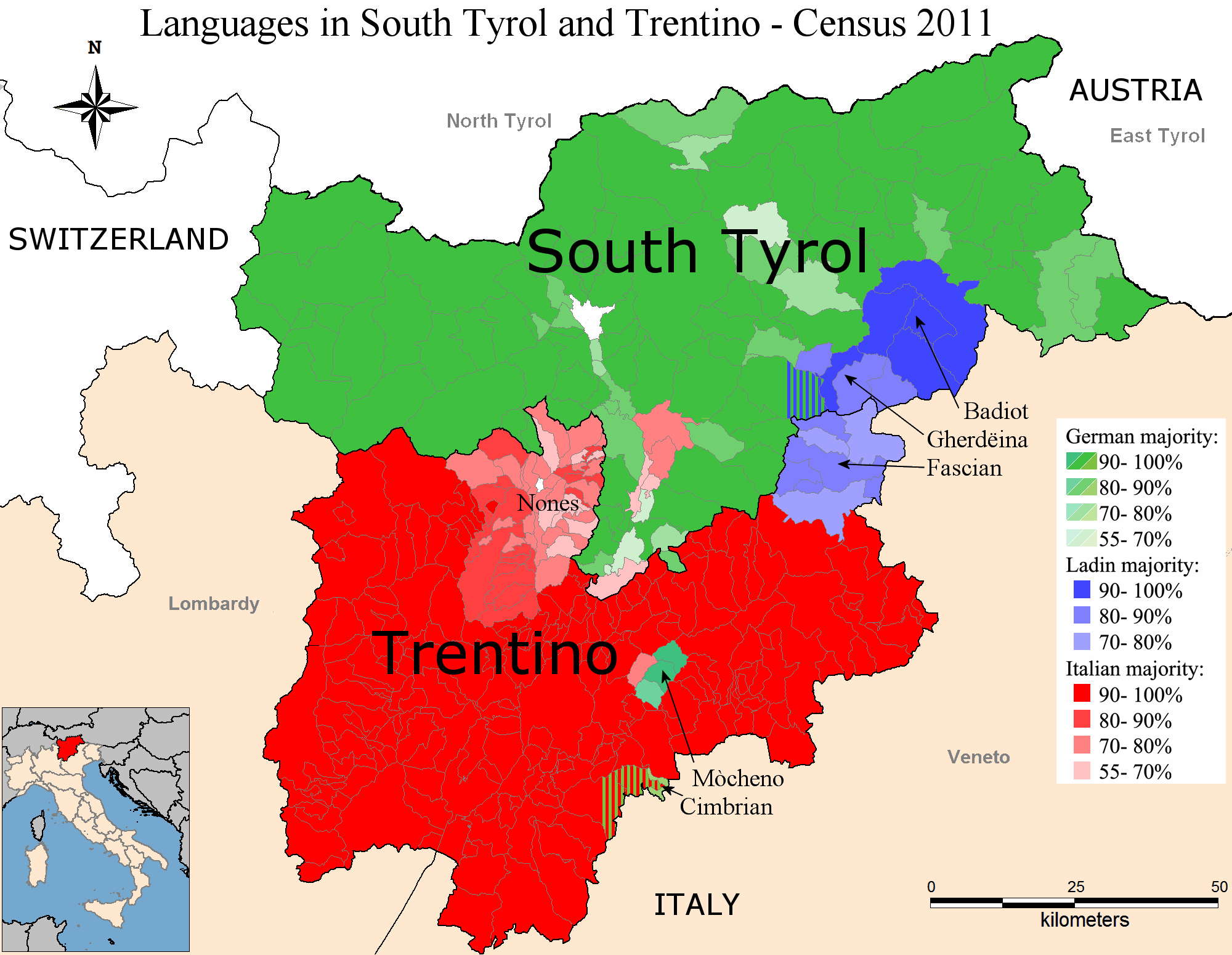
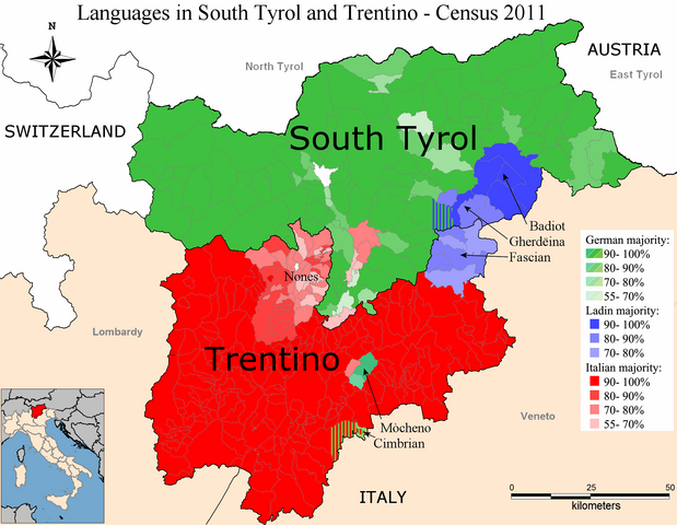
English: Map of South Tyrol and Trentino with Language distribution based on Census data from 2011. Please note that the method of gathering statistical data on the population in the two provinces was different and the data aren't directly comparable.
Colours:
|
| Date | |
| Source |
Map based upon:
Data from:
|
| Author | Sajoch |
Licensing
I, the copyright holder of this work, hereby publish it under the following license:
This file is licensed under the Creative Commons Attribution-Share Alike 3.0 Unported license.
- You are free:
- to share – to copy, distribute and transmit the work
- to remix – to adapt the work
- Under the following conditions:
- attribution – You must give appropriate credit, provide a link to the license, and indicate if changes were made. You may do so in any reasonable manner, but not in any way that suggests the licensor endorses you or your use.
- share alike – If you remix, transform, or build upon the material, you must distribute your contributions under the same or compatible license as the original.
File history
Click on a date/time to view the file as it appeared at that time.
| Date/Time | Dimensions | User | Comment | |
|---|---|---|---|---|
| current | 00:17, 8 January 2013 | 2,000 × 1,550 (235 KB) | Gryffindor | Reverted to version as of 15:48, 6 January 2013 |
File usage
The following page uses this file: