File:Lundy by Henry Mangles Denham 1804.jpg
Size of this preview: 415 × 599 pixels. Other resolutions: 166 × 240 pixels | 333 × 480 pixels | 416 × 600 pixels | 532 × 768 pixels | 710 × 1,024 pixels | 2,773 × 4,000 pixels.
Original file (2,773 × 4,000 pixels, file size: 2.57 MB, MIME type: image/jpeg)
| This is a file from the Wikimedia Commons. The description on its description page there is shown below.
|
Summary
| Description |
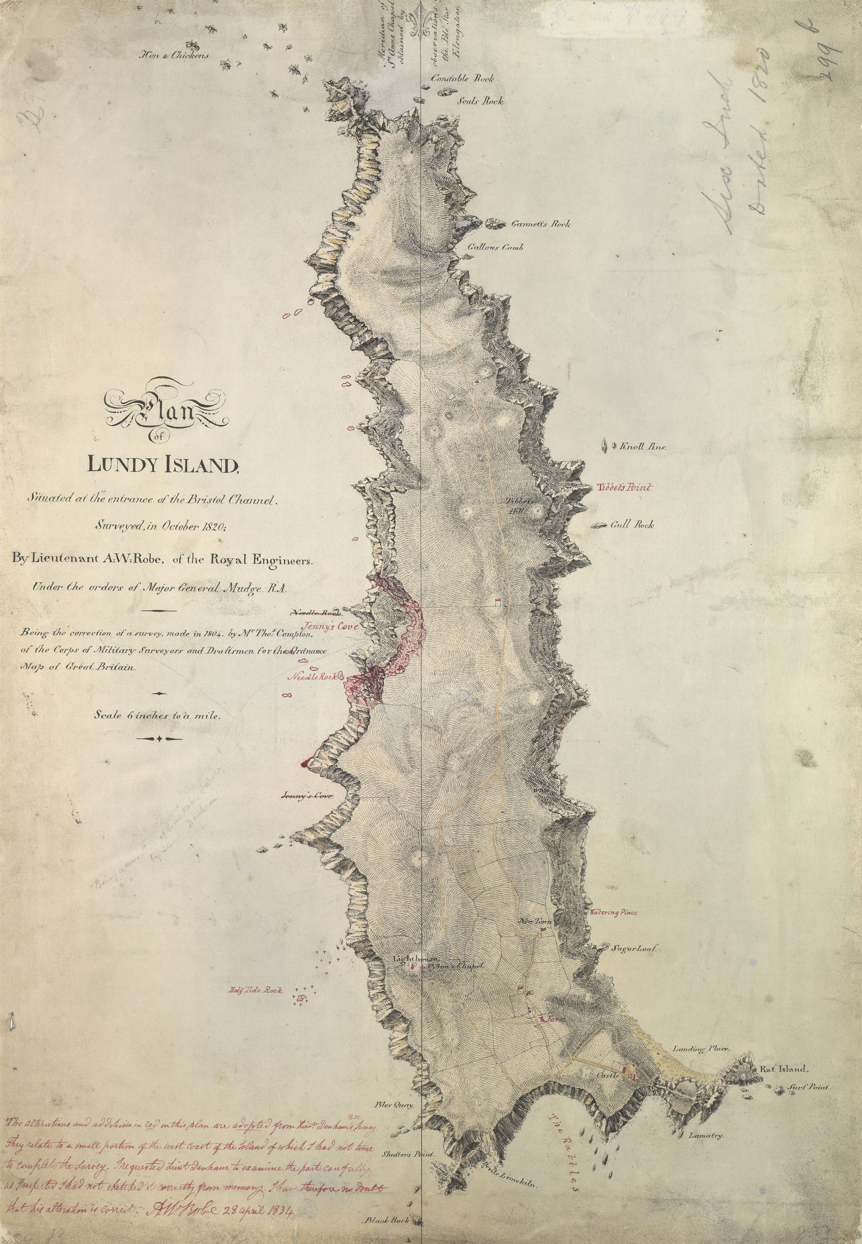
English: Map of Lundy Island, Bristol Channel, England |
| Date | 1804, corrections from 1834 |
| Source | http://www.bl.uk/onlinegallery/onlineex/ordsurvdraw/other/002osd00000027bu00449000.html |
| Author | Henry Mangles Denham, after Thomas Compton |
| Camera location | | View this and other nearby images on: OpenStreetMap |
|---|
Licensing
|
This work is in the public domain in its country of origin and other countries and areas where the copyright term is the author's life plus 100 years or fewer. This work is in the public domain in the United States because it was published (or registered with the U.S. Copyright Office) before January 1, 1929. | |
| This file has been identified as being free of known restrictions under copyright law, including all related and neighboring rights. | |
File history
Click on a date/time to view the file as it appeared at that time.
| Date/Time | Dimensions | User | Comment | |
|---|---|---|---|---|
| current | 14:36, 28 November 2014 | 2,773 × 4,000 (2.57 MB) | Ratzer | User created page with UploadWizard |
File usage
The following page uses this file: