File:Map Okuyama Niikawa 1836.jpg
Original file (1,787 × 1,407 pixels, file size: 2.16 MB, MIME type: image/jpeg)
| This is a file from the Wikimedia Commons. The description on its description page there is shown below.
|
Summary
| Description |
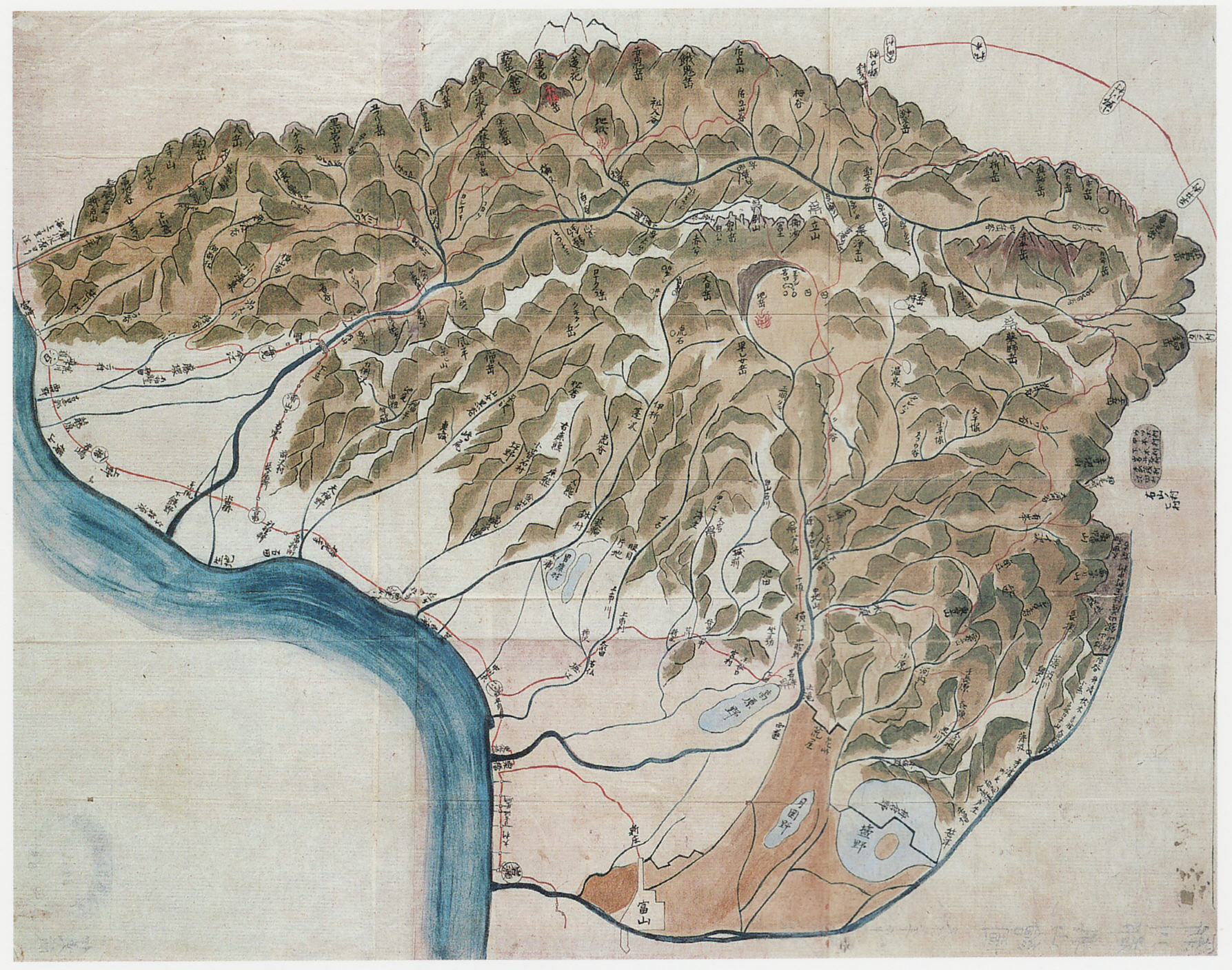
English: Illustrated map (copy) of the deep mountain in Niikawa County, Etchū Province in 1836.
日本語: 『新川郡奥山絵圖』古写図、天保7年。 |
| Date | |
| Source | 富山県立図書館所蔵 |
| Author | 脇坂長右衛門 |
| Camera location | | View this and other nearby images on: OpenStreetMap |
|---|
Licensing
According to Japanese Copyright Law (June 1, 2018 grant) the copyright on this work has expired and is as such public domain. According to articles 51, 52, 53 and 57 of the copyright laws of Japan, under the jurisdiction of the Government of Japan works enter the public domain 50 years after the death of the creator (there being multiple creators, the creator who dies last) or 50 years after publication for anonymous or pseudonymous authors or for works whose copyright holder is an organization.
Note: The enforcement of the revised Copyright Act on December 30, 2018 extended the copyright term of works whose copyright was valid on that day to 70 years. Do not use this template for works of the copyright holders who died after 1967. Use {{PD-Japan-oldphoto}} for photos published before December 31, 1956, and {{PD-Japan-film}} for films produced prior to 1953. Public domain works must be out of copyright in both the United States and in the source country of the work in order to be hosted on the Commons. The file must have an additional copyright tag indicating the copyright status in the United States. See also Copyright rules by territory.
|
 |
File history
Click on a date/time to view the file as it appeared at that time.
| Date/Time | Dimensions | User | Comment | |
|---|---|---|---|---|
| current | 04:21, 19 November 2010 | 1,787 × 1,407 (2.16 MB) | Pinqui | {{Information |Description={{en|1=Illustrated map (copy) of the deep mountain in Niikawa County, Etchū Province in 1836.}} {{ja|1=越中新川郡奥山絵図の古写図。天保7年。}} |Source=富山県立図書館所蔵 |Author=脇坂長右衛門 |Da |
File usage
The following page uses this file: