File:Map indonesia volcanoes.gif
No higher resolution available.
Map_indonesia_volcanoes.gif (731 × 410 pixels, file size: 25 KB, MIME type: image/gif)
| This is a file from the Wikimedia Commons. The description on its description page there is shown below.
|

|
This geology image could be re-created using vector graphics as an SVG file. This has several advantages; see Commons:Media for cleanup for more information. If an SVG form of this image is available, please upload it and afterwards replace this template with
{{vector version available|new image name}}.
It is recommended to name the SVG file “Map indonesia volcanoes.svg”—then the template Vector version available (or Vva) does not need the new image name parameter. |
| Description |
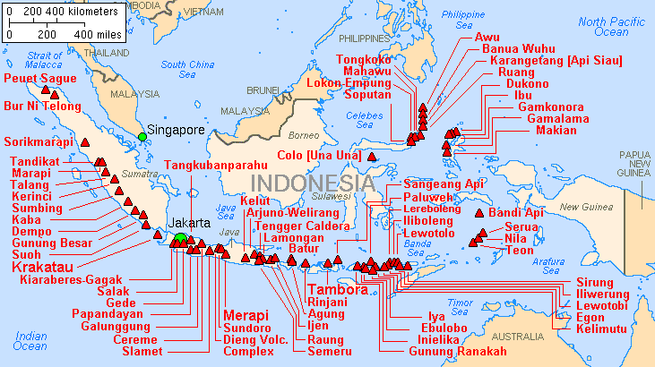
English: Major volcanoes of Indonesia, with eruptions since 1900 AD |
|||
| Date | ||||
| Source | Archived source link | |||
| Author | Lyn Topinka, USGS; base map from CIA, 1997; volcanoes from Simkin and Siebert, 1994 | |||
| Permission (Reusing this file) |
|
File history
Click on a date/time to view the file as it appeared at that time.
| Date/Time | Dimensions | User | Comment | |
|---|---|---|---|---|
| current | 06:21, 16 February 2014 | 731 × 410 (25 KB) | Hike395 | Crop title, logo, border, credit line |
File usage
The following page uses this file: