File:Map of Central Asia with trade routes and movements, von Richthofen.png
Size of this preview: 800 × 483 pixels. Other resolutions: 320 × 193 pixels | 640 × 386 pixels | 1,024 × 618 pixels | 1,280 × 772 pixels | 2,034 × 1,227 pixels.
Original file (2,034 × 1,227 pixels, file size: 4.8 MB, MIME type: image/png)
| This is a file from the Wikimedia Commons. The description on its description page there is shown below.
|
Summary
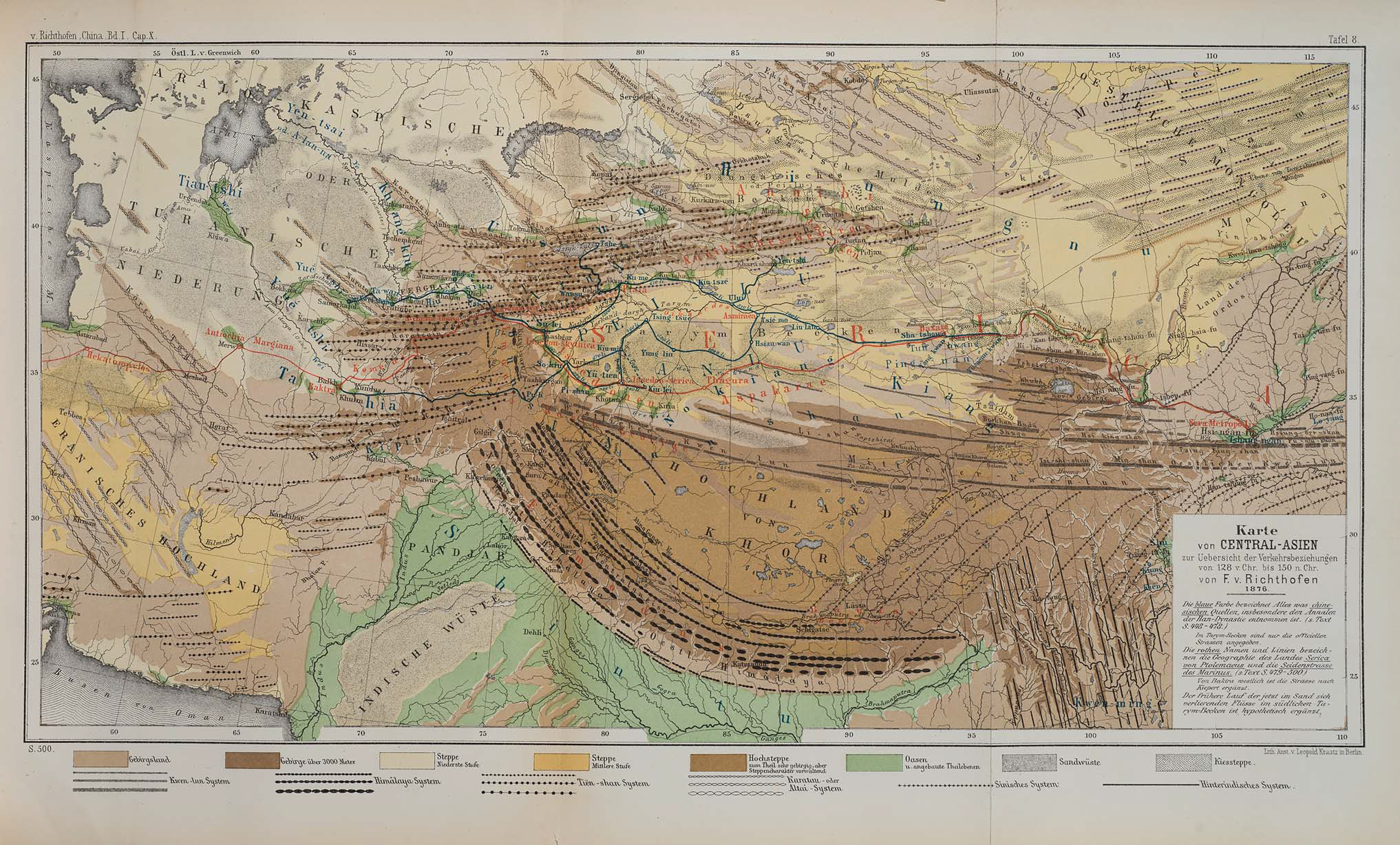
| Description | Map of Central Asia for overview of trade routes and movements from 128 BC to 150 AD |
| Date |
Dated 1876 Published 1877 |
| Source |
F. von Richthofen (1877). China: Ergebnisse eigener Reisen und darauf gegründeter Studien. Band 1, Einleitender Theil [China: Expedition results and studies based thereupon. Volume 1, Introductory Part]. Berlin: Verlag von Dietrich Reimer. As reproduced in James D. Sidaway & Chih Yuan Woon (2017). Chinese Narratives on “One Belt, One Road” (一带一路) in Geopolitical and Imperial Contexts. The Professional Geographer 69(4), 591-603. doi: 10.1080/00330124.2017.1288576 |
| Author | F. von Richthofen (1833–1905) |
| Other versions |
.png)
Licensing
|
This work is in the public domain in its country of origin and other countries and areas where the copyright term is the author's life plus 100 years or fewer. | |
| This file has been identified as being free of known restrictions under copyright law, including all related and neighboring rights. | |
| Annotations | This image is annotated: View the annotations at Commons |
File history
Click on a date/time to view the file as it appeared at that time.
| Date/Time | Dimensions | User | Comment | |
|---|---|---|---|---|
| current | 01:14, 24 November 2018 | 2,034 × 1,227 (4.8 MB) | Cold Season | {{Information |Description= Map of Central Asia for overview of trade routes and movements. |Source= Von Richthofen, F. (1877). ''China: Ergebnisse eigener Reisen und darauf gegründeter Studien''. Band 1, Einleitender Theil [China: Expedition results and studies based thereupon. Volume 1, Introductory Part]. Berlin: Verlag von Dietrich Reimer. As reproduced in James D. Sidaway & Chih Yuan Woon (2017) Chinese Narratives on “One Belt, One Road” (一带一路) in Geopolitical and Imperial Contexts, ''T... |
File usage
The following page uses this file: