File:Map of Constantinople (1422) by Florentine cartographer Cristoforo Buondelmonte.jpg
Size of this preview: 476 × 600 pixels. Other resolutions: 190 × 240 pixels | 592 × 746 pixels.
Original file (592 × 746 pixels, file size: 838 KB, MIME type: image/jpeg)
| This is a file from the Wikimedia Commons. The description on its description page there is shown below.
|
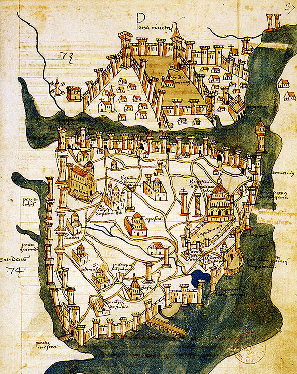
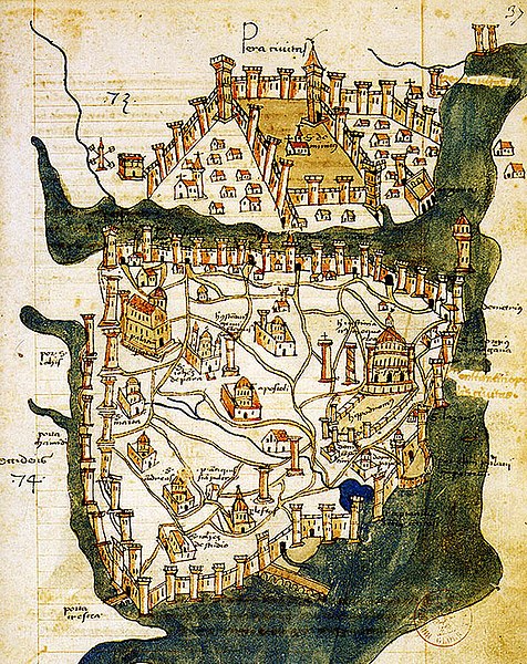
| Description | Map of Constantinople (a small part of modern Istanbul), called "Historic Peninsula", Tarihi Yarımada en Turkish) designed in 1422 by Florentine cartographer Cristoforo Buondelmonti (Description des îles de l'archipel, Bibliothèque nationale, Paris) is the oldest surviving map of the city, and the only surviving map which predates the Turkish conquest of Constantinople in 1453. | ||||
| Date | |||||
| Source | Liber insularum Archipelagi (1824), version available at the Bibliothèque nationale de France, Paris | ||||
| Author | Cristoforo Buondelmonti | ||||
| Permission (Reusing this file) |
|
||||
| Other versions |
|
||||

_by_Florentine_cartographer_Cristoforo_Buondelmonte.jpg)
File history
Click on a date/time to view the file as it appeared at that time.
| Date/Time | Dimensions | User | Comment | |
|---|---|---|---|---|
| current | 03:24, 25 June 2007 | 592 × 746 (838 KB) | M.K. | {{Information |Description=Map of Constantinople (1422) by Florentine cartographer Cristoforo Buondelmonte (''Description des îles de l'archipel'', Bibliothèque nationale, Paris) is the oldest surviving map of the city, and the only surviving ma |
File usage
The following 2 pages use this file:
_by_Florentine_cartographer_Cristoforo_Buondelmonte.jpg)