File:Map of Lake Toba.jpg
Size of this preview: 738 × 600 pixels. Other resolutions: 295 × 240 pixels | 591 × 480 pixels | 945 × 768 pixels | 1,260 × 1,024 pixels | 4,037 × 3,282 pixels.
Original file (4,037 × 3,282 pixels, file size: 4.76 MB, MIME type: image/jpeg)
| This is a file from the Wikimedia Commons. The description on its description page there is shown below.
|
Summary
| Description |
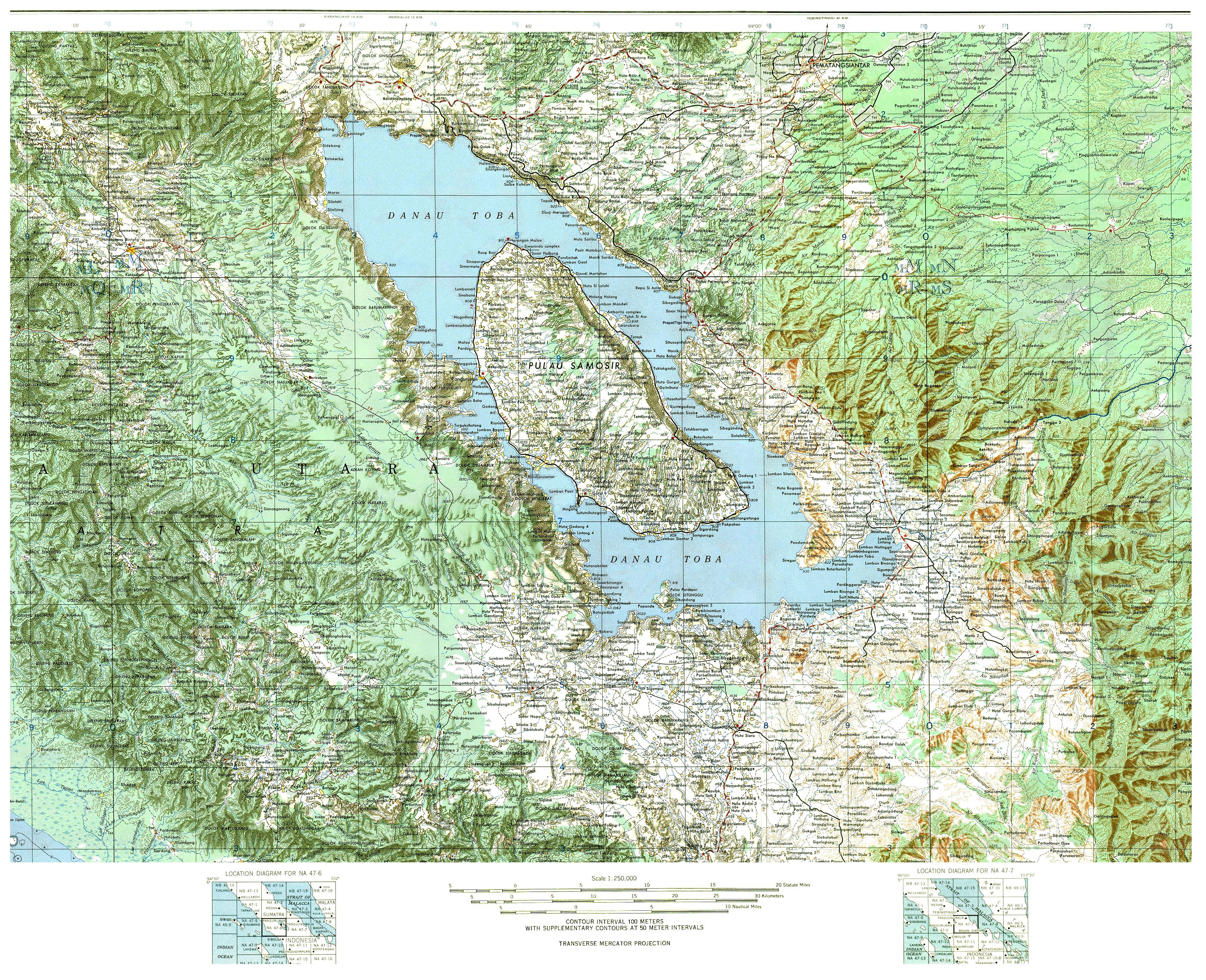
Deutsch: Tobasee
English: Lake Toba - Danau Toba |
| Date | Unknown date (uploaded 2011) |
| Source |
(Original text: U. S. Army Map Service (Indonesia 1:250.000, Edition 1 - AMS). Zusammengesetzte Ausschnitte aus den Blättern NA 47-6 (Pangururan) und NA 47-7 (Tandjungbalai)) Bearbeitet von Geoethno. |
| Author | Unknown author |
| Object location | | View this and other nearby images on: OpenStreetMap |
|---|
| This is a retouched picture, which means that it has been digitally altered from its original version. Modifications: Zusammengesetzt. In der zweiten Version: ein Ortsname am Nordende der Insel Samosir war falsch: Sinanindo müsste Simanindo heissen, auch habe ich in der zweiten Version einige der hässlichen grauen Rasterpunkte im See beseitigt. Modifications made by Geoethno.
|
Licensing
This file is a work of a U.S. Army soldier or employee, taken or made as part of that person's official duties. As a work of the U.S. federal government, it is in the public domain in the United States.
|
 |
Original upload log
The original description page was here. All following user names refer to de.wikipedia.
- 2011-01-30 13:01 Geoethno 4037×3282× (29493767 bytes) {{Information |Beschreibung = |Quelle = |Urheber = |Datum = |Genehmigung = |Andere Versionen = |Anmerkungen = }}
- 2011-01-30 12:43 Geoethno 4037×3282× (30606787 bytes) {{Information |Beschreibung = Lake Toba - Danau Toba - Tobasee |Quelle = U. S. Army Map Service (Indonesia 1:250.000, Edition 1 - AMS). Zusammengesetzte Ausschnitte aus den Blättern NA 47-6 (Pangururan) und NA 47-7 (Tandjungbalai) |Urheber
File history
Click on a date/time to view the file as it appeared at that time.
| Date/Time | Dimensions | User | Comment | |
|---|---|---|---|---|
| current | 11:20, 30 January 2011 | 4,037 × 3,282 (4.76 MB) | Geoethno | Versuch einer jpg-Datei in besserer Qualität |
File usage
The following page uses this file: