File:Map of Ontario GOLDEN HORSESHOE.svg

Size of this PNG preview of this SVG file: 340 × 330 pixels. Other resolutions: 247 × 240 pixels | 495 × 480 pixels | 618 × 600 pixels | 791 × 768 pixels | 1,055 × 1,024 pixels.
Original file (SVG file, nominally 340 × 330 pixels, file size: 84 KB)
| This is a file from the Wikimedia Commons. The description on its description page there is shown below.
|
Summary
This W3C-unspecified vector image was created with Inkscape .
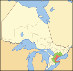
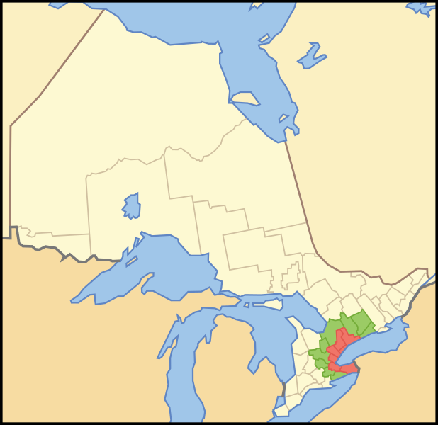
| Description | A map showing which census divisions make up the en:Golden Horseshoe (red) and the Greater Golden Horseshoe (Green) |
| Date | |
| Source | Crop and trace of Image:Canada (geolocalisation).svg; trace of Image:Ontario subdivisions.PNG. |
| Author | Vidioman |
| Other versions | en:Image:Goldhorse.PNG |
.svg)
Licensing
| I, the copyright holder of this work, release this work into the public domain. This applies worldwide. In some countries this may not be legally possible; if so: I grant anyone the right to use this work for any purpose, without any conditions, unless such conditions are required by law. |
File history
Click on a date/time to view the file as it appeared at that time.
| Date/Time | Dimensions | User | Comment | |
|---|---|---|---|---|
| current | 05:08, 15 October 2007 | 340 × 330 (84 KB) | Vidioman | {{Created with Inkscape}} {{Information |Description=A map showing which census divisions make up the Golden Horseshoe (red) and the Greater Golden Horseshoe (Green) |Source=Crop and trace of Image:Canada (geolocalisation).svg; trace of [http://en.wi |
.svg)
File usage
The following page uses this file: