File:Melbourne RRL.png

Size of this preview: 768 × 599 pixels. Other resolutions: 308 × 240 pixels | 615 × 480 pixels | 769 × 600 pixels | 984 × 768 pixels | 1,280 × 999 pixels | 1,481 × 1,156 pixels.
Original file (1,481 × 1,156 pixels, file size: 281 KB, MIME type: image/png)
| This is a file from the Wikimedia Commons. The description on its description page there is shown below.
|
| Description |
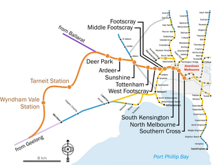
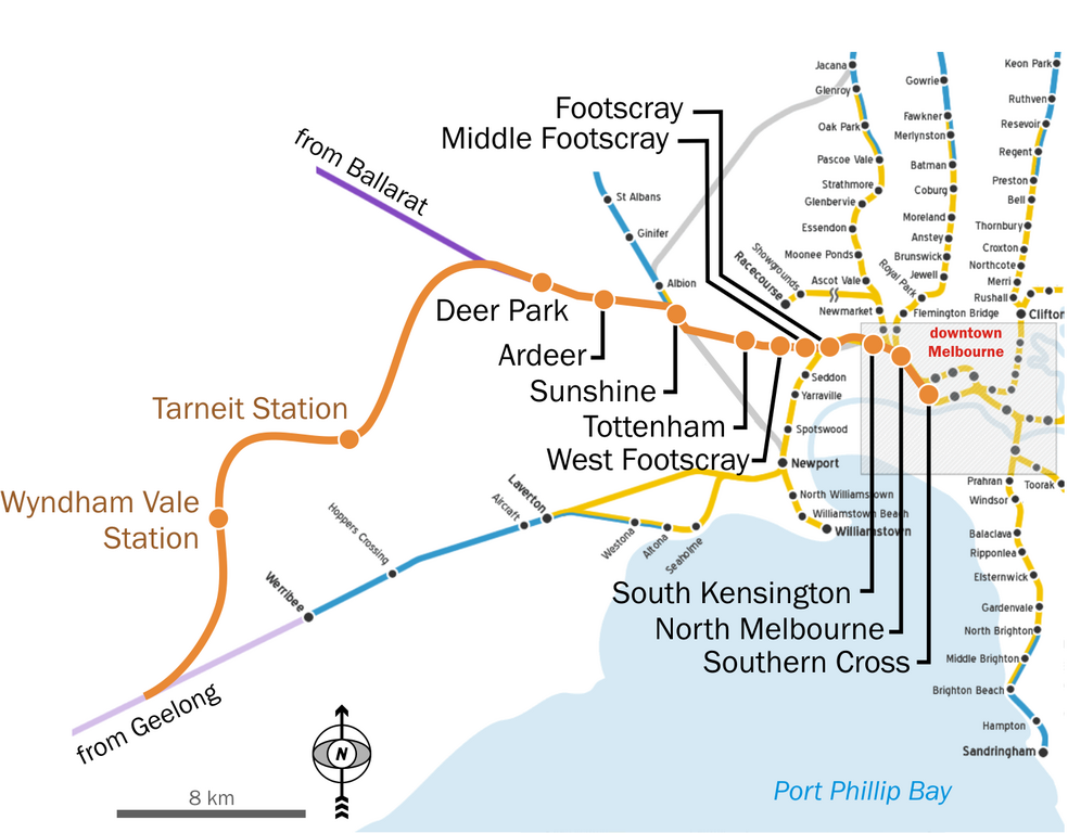
English: Map of Melbourne's railway network, geographically accurate, with the projected Regional Rail Link. |
| Date | (UTC) |
| Source | |
| Author |
Original uploader was JohnnoShadbolt at en.wikipedia
|
I, the copyright holder of this work, hereby publish it under the following license:
This file is licensed under the Creative Commons Attribution 2.5 Generic license.
- You are free:
- to share – to copy, distribute and transmit the work
- to remix – to adapt the work
- Under the following conditions:
- attribution – You must give appropriate credit, provide a link to the license, and indicate if changes were made. You may do so in any reasonable manner, but not in any way that suggests the licensor endorses you or your use.
Original upload log
This image is a derivative work of the following images:
- File:Melbourne_railways_map.gif licensed with Cc-by-2.5
- 2009-08-02T01:43:15Z File Upload Bot (Magnus Manske) 2126x2325 (209777 Bytes) {{BotMoveToCommons|en.wikipedia|year={{subst:CURRENTYEAR}}|month={{subst:CURRENTMONTHNAME}}|day={{subst:CURRENTDAY}}}} {{Information |Description={{en|Map of [[:en:Melbourne|Melbourne's]] railway network, geographically accu
Uploaded with derivativeFX
File history
Click on a date/time to view the file as it appeared at that time.
| Date/Time | Dimensions | User | Comment | |
|---|---|---|---|---|
| current | 12:03, 24 August 2010 | 1,481 × 1,156 (281 KB) | Classical geographer | {{Information |Description={{en|Map of Melbourne's railway network, geographically accurate, with the projected w:Regional Rail Link.}} |Source=*File:Melbourne_railways_map.gif |Date=2010-08-24 19:03 (UTC) |Author=*[[:File:Me |
File usage
The following page uses this file: