File:Milecastle 39 on Hadrian's Wall.jpg

Size of this preview: 800 × 533 pixels. Other resolutions: 320 × 213 pixels | 640 × 427 pixels | 1,024 × 683 pixels | 1,280 × 853 pixels | 2,304 × 1,536 pixels.
Original file (2,304 × 1,536 pixels, file size: 920 KB, MIME type: image/jpeg)
| This is a file from the Wikimedia Commons. The description on its description page there is shown below.
|
Summary
| Description |
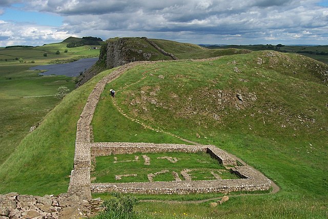
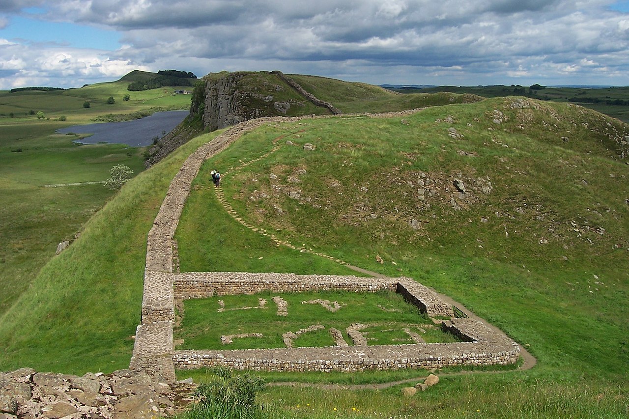
English: The remains of Milecastle 39 (coordinates 55° 0' 13.12" N, 2° 22' 32.74" W) on Hadrian's Wall; near Steel Rigg, looking east from a ridge along the Hadrian's Wall Path. Milecastle 39 is also known as Castle Nick.
Svenska: Ruinerna efter Milecastle 39 (koordinater 55° 0' 13.12" N, 2° 22' 32.74" V), beläget nära Steel Rigg utmed Hadrianus mur. Fortifikationen – som också kallas Castle Nick – vetter mot öster och är byggd på en ås längs vandringsleden Hadrian's Wall Path. |
||
| Date | |||
| Source | Photograph by uploader | ||
| Author | Adam Cuerden | ||
| Permission (Reusing this file) |
|
File history
Click on a date/time to view the file as it appeared at that time.
| Date/Time | Dimensions | User | Comment | |
|---|---|---|---|---|
| current | 07:16, 30 June 2007 | 2,304 × 1,536 (920 KB) | Adam Cuerden | Milecastle 39 on Hadrian's Wall, near Steel Rigg. |
File usage
The following 2 pages use this file: