File:New York Combined Metro Area.png

Size of this preview: 654 × 600 pixels. Other resolutions: 262 × 240 pixels | 524 × 480 pixels | 838 × 768 pixels | 1,117 × 1,024 pixels | 2,395 × 2,196 pixels.
Original file (2,395 × 2,196 pixels, file size: 1.19 MB, MIME type: image/png)
| This is a file from the Wikimedia Commons. The description on its description page there is shown below.
|
Summary
| Description |
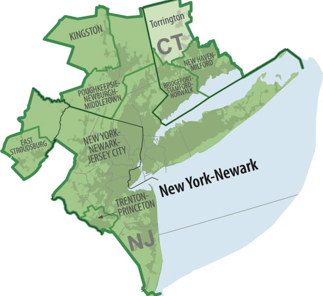
English: A cutout of the U.S. Census Bureau's Combined Statistical Area of the Greater New York Metro Area |
| Date | |
| Source |
Combined Statistical Areas of the United States and Puerto Rico -- March 2020 https://www2.census.gov/geo/maps/metroarea/us_wall/Mar2020/CSA_WallMap_Mar2020.pdf |
| Author | U.S. Census Bureau |
Licensing
This image or file is a work of a United States Census Bureau employee, taken or made as part of that person's official duties. As a work of the U.S. federal government, the image is in the public domain.
|
 |
File history
Click on a date/time to view the file as it appeared at that time.
| Date/Time | Dimensions | User | Comment | |
|---|---|---|---|---|
| current | 08:37, 10 August 2022 | 2,395 × 2,196 (1.19 MB) | Mlaurenti | Uploaded a work by U.S. Census Bureau from Combined Statistical Areas of the United States and Puerto Rico -- March 2020 https://www2.census.gov/geo/maps/metroarea/us_wall/Mar2020/CSA_WallMap_Mar2020.pdf with UploadWizard |
File usage
The following page uses this file: