File:Northern Gulf of Mexico map.png

Size of this preview: 800 × 486 pixels. Other resolutions: 320 × 194 pixels | 640 × 389 pixels | 1,024 × 622 pixels | 1,280 × 778 pixels | 2,526 × 1,535 pixels.
Original file (2,526 × 1,535 pixels, file size: 306 KB, MIME type: image/png)
| This is a file from the Wikimedia Commons. The description on its description page there is shown below.
|
| Description |
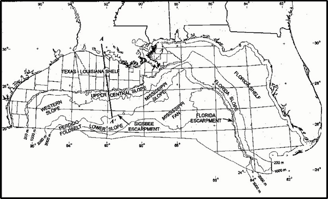
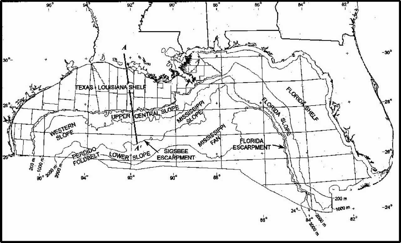
English: Map of northern part of Gulf of Mexico. Major physiogeograaphic features of the northern part of Gulf of Mexico outer continental shelf. |
| Date | |
| Source | Minerals Management Service. Gulf of Mexico OCS Region. (May 2000). Gulf of Mexico Deepwater Operations and Activities. Environmental Assessment. U.S. Department of the Interior, Minerals Management Service, Gulf of Mexico OCS Region, New Orleans. Figure III-1. |
| Author | Minerals Management Service. Gulf of Mexico OCS Region |
| This article or image contains material based on a work of a Minerals Management Service employee, created as part of that person's official duties. As a work of the U.S. federal government, such work is in the public domain in the United States. See MMS Disclaimer. |  |
File history
Click on a date/time to view the file as it appeared at that time.
| Date/Time | Dimensions | User | Comment | |
|---|---|---|---|---|
| current | 12:38, 4 May 2010 | 2,526 × 1,535 (306 KB) | Snek01 | {{Information |Description={{en|Map of northern part of Gulf of Mexico. Major physiogeograaphic features of the northern part of Gulf of Mexico outer continental shelf.}} |Source=Minerals Management Service. Gulf of Mexico OCS Region. (May 2000). ''Gulf o |
File usage
The following page uses this file: