File:Pacific Theater Areas;map1.JPG
Size of this preview: 800 × 582 pixels. Other resolutions: 320 × 233 pixels | 640 × 466 pixels | 1,024 × 746 pixels | 1,199 × 873 pixels.
Original file (1,199 × 873 pixels, file size: 351 KB, MIME type: image/jpeg)
| This is a file from the Wikimedia Commons. The description on its description page there is shown below.
|

|
File:Pacific Theater Areas;map1.svg is a vector version of this file. It should be used in place of this JPG file when not inferior.
File:Pacific Theater Areas;map1.JPG → File:Pacific Theater Areas;map1.svg
For more information, see Help:SVG. |
 |
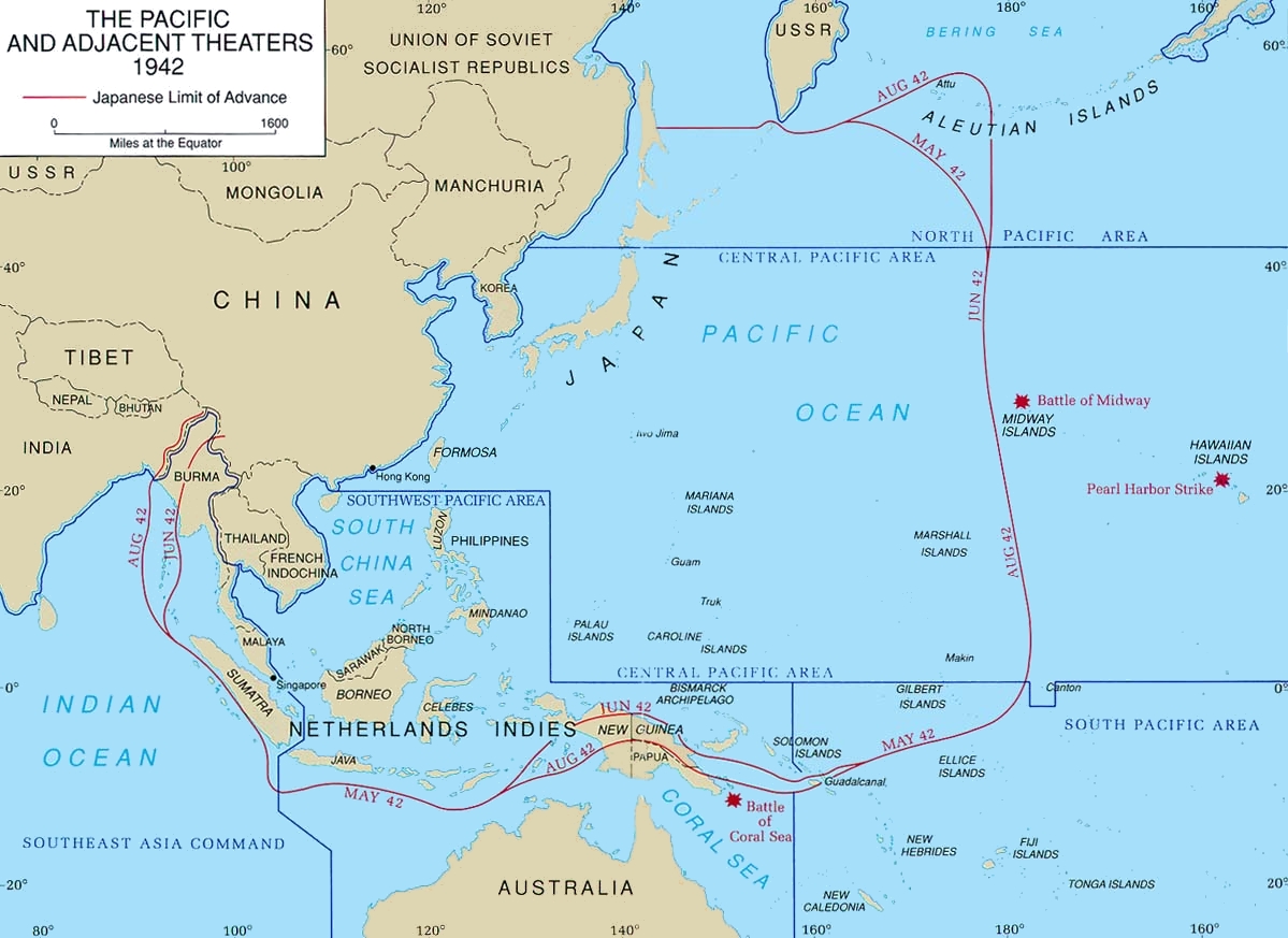
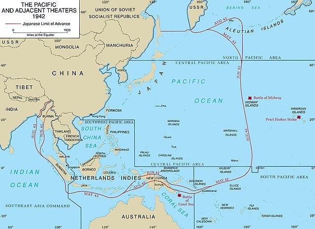
Map of Pacific theater of operations during World War II showing the boundaries of the Japanese Empire. Newell, Clayton R. (2003). Central Pacific. The US Army Campaigns of World War II. US Army Center of Military History. Archived from the original on 2012-02-02. Retrieved on 2008-08-06.
This file is a work of a U.S. Army soldier or employee, taken or made as part of that person's official duties. As a work of the U.S. federal government, it is in the public domain in the United States.
|
 |
File history
Click on a date/time to view the file as it appeared at that time.
| Date/Time | Dimensions | User | Comment | |
|---|---|---|---|---|
| current | 13:43, 18 January 2018 | 1,199 × 873 (351 KB) | Hohum | Cleanup |
File usage
The following page uses this file: