File:PointeDuHoc.png

Original file (3,200 × 2,400 pixels, file size: 276 KB, MIME type: image/png)
| This is a file from the Wikimedia Commons. The description on its description page there is shown below.
|
Summary
| Description |
|
||
| Date | |||
| Source | Own work | ||
| Creator | |||
| Credit line | © Tom Fish, geo.fish // Creative Commons BY-SA 4.0 | ||
| Permission (Reusing this file) |
|
||
| Georeferencing | If inappropriate please set warp_status = skip to hide. | ||
| PNG development | This map was created with ArcGIS Pro. |
Licensing
Data
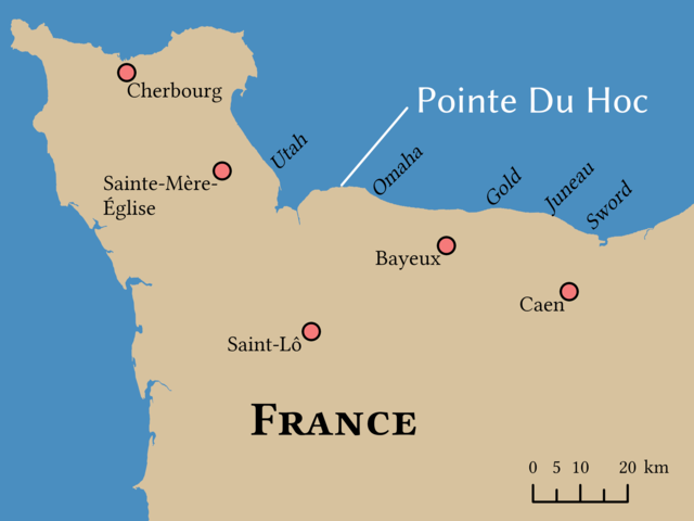
Land
The land layer was sourced from the Large Scale International Boundaries published by the US Department of State
| This image is a work of a United States Department of State employee, taken or made as part of that person's official duties. As a work of the U.S. federal government, the image is in the public domain per 17 U.S.C. § 101 and § 105 and the Department Copyright Information. |  |
Locations
the locations of cities in France, Landing Zones, and Pointe du Hoc are facts and are not eligible for copyright protection. While other sources were used to verify the locations, they were placed by hand and are not derived from a GIS layer
| This work is ineligible for copyright and therefore in the public domain because it consists entirely of information that is common property and contains no original authorship. |
Final Map
- You are free:
- to share – to copy, distribute and transmit the work
- to remix – to adapt the work
- Under the following conditions:
- attribution – You must give appropriate credit, provide a link to the license, and indicate if changes were made. You may do so in any reasonable manner, but not in any way that suggests the licensor endorses you or your use.
- share alike – If you remix, transform, or build upon the material, you must distribute your contributions under the same or compatible license as the original.
File history
Click on a date/time to view the file as it appeared at that time.
| Date/Time | Dimensions | User | Comment | |
|---|---|---|---|---|
| current | 07:27, 10 November 2021 | 3,200 × 2,400 (276 KB) | Guerillero | Increase size of Pointe Du Hoc label |
File usage
The following page uses this file: