File:Roman Empire 69.svg

Size of this PNG preview of this SVG file: 798 × 600 pixels. Other resolutions: 319 × 240 pixels | 639 × 480 pixels | 1,022 × 768 pixels | 1,280 × 962 pixels | 2,228 × 1,675 pixels.
Original file (SVG file, nominally 2,228 × 1,675 pixels, file size: 677 KB)
| This is a file from the Wikimedia Commons. The description on its description page there is shown below.
|
Summary
| Description |
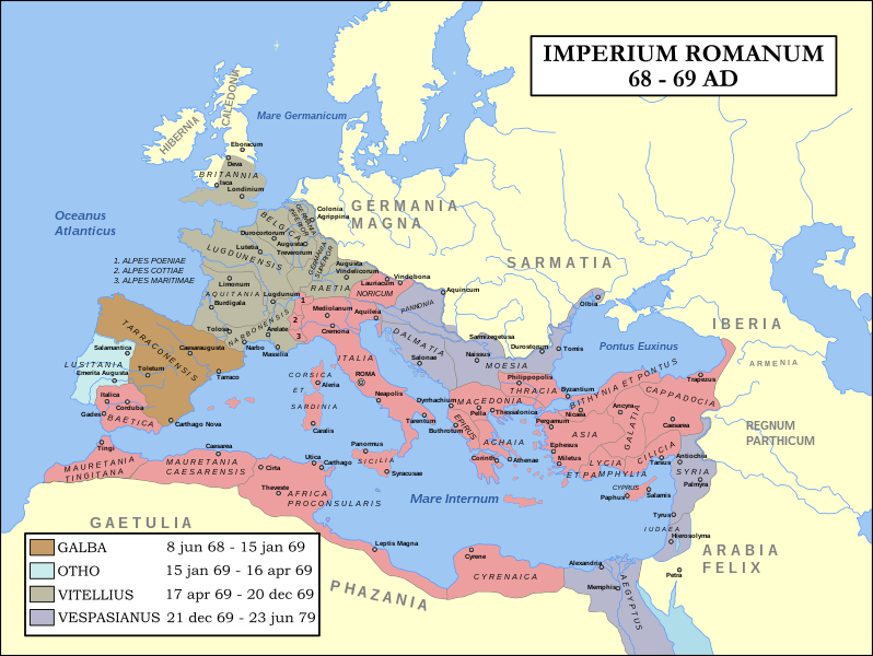
English: Map of the Roman Empire during 69AD, the Year of the Four Emperors. Coloured areas indicate provinces loyal to one of four warring generals.
Français : Carte de l'Empire romain en l'an 69 après J-C.
Nederlands: Kaart van het Romeinse Rijk in 68-69 n.Chr., het Vierkeizersjaar. De ingekleurde gebieden geven aan welke provinciae aan welke troonpredent loyaal waren. |
| Date | 23 December 2007 and 5 May 2008 |
| Source | Combination of Roman Empire 69AD.PNG and Roman Empire 120.svg |
| Author | Steerpike and ArdadN |
| Permission (Reusing this file) |
See files. |
| Other versions |
[]
|
| SVG development |


.svg)


Licensing
This file is licensed under the Creative Commons Attribution-Share Alike 3.0 Netherlands license.
- You are free:
- to share – to copy, distribute and transmit the work
- to remix – to adapt the work
- Under the following conditions:
- attribution – You must give appropriate credit, provide a link to the license, and indicate if changes were made. You may do so in any reasonable manner, but not in any way that suggests the licensor endorses you or your use.
- share alike – If you remix, transform, or build upon the material, you must distribute your contributions under the same or compatible license as the original.

File history
Click on a date/time to view the file as it appeared at that time.
| Date/Time | Dimensions | User | Comment | |
|---|---|---|---|---|
| current | 11:50, 10 November 2013 | 2,228 × 1,675 (677 KB) | Fulvio314 | Britannia borders set back to real 69 (wrongly set to 140) |
File usage
The following 4 pages use this file: