File:SakaiminatoCity.jpg
Size of this preview: 800 × 600 pixels. Other resolutions: 320 × 240 pixels | 640 × 480 pixels | 1,024 × 768 pixels | 1,280 × 960 pixels.
Original file (1,280 × 960 pixels, file size: 377 KB, MIME type: image/jpeg)
| This is a file from the Wikimedia Commons. The description on its description page there is shown below.
|
Summary
| Description |
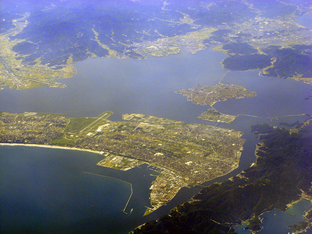
English: Aerial view of Sakaiminato (foreground) and Matsue (background to right foreground) in Tottori Prefecture, Japan |
| Date | |
| Source | SakaiminatoCity.jpg (Transferred from Japanese Wikipedia) |
| Author | BehBeh |
| Object location | | View this and other nearby images on: OpenStreetMap |
|---|
Licensing
| This file is licensed under the Creative Commons Attribution-Share Alike 3.0 Unported license. Subject to disclaimers. | ||
| ||
| This licensing tag was added to this file as part of the GFDL licensing update. |

|
Permission is granted to copy, distribute and/or modify this document under the terms of the GNU Free Documentation License, Version 1.2 or any later version published by the Free Software Foundation; with no Invariant Sections, no Front-Cover Texts, and no Back-Cover Texts. A copy of the license is included in the section entitled GNU Free Documentation License. Subject to disclaimers. |
Original upload log
The original description page was here. All following user names refer to ja.wikipedia.
- 2007-10-21 00:55 BehBeh 1280×960×8 (386167 bytes) {{GFDL}} 2007年9月19日撮影。[[境港市]]空撮画像。奥は[[中海]]手前は[[美保湾]]。滑走路は[[美保飛行場|米子空港]]。撮影者投稿。 [[Category:鳥取県の画像]] [[Category:境港市の画像]] [[Category:空港画�
| Annotations | This image is annotated: View the annotations at Commons |
| This file was moved from Japanese Wikipedia.
See below for original file information. | ||||||||||||||||||||||||||||
| ||||||||||||||||||||||||||||
|
| ||||||||||||||||||||||||||||
File history
Click on a date/time to view the file as it appeared at that time.
| Date/Time | Dimensions | User | Comment | |
|---|---|---|---|---|
| current | 11:52, 27 January 2008 | 1,280 × 960 (377 KB) | Arthena | {{Information |Description={{ja|2007年9月19日撮影。ja:境港市空撮画像。奥はja:中海手前はja:美保湾。滑走路は米子空港。撮影者投稿。 ja:Category:鳥取県の画像 [[:ja:Categ |
File usage
The following 2 pages use this file: