File:Satellite image of Flevopolder, Netherlands (5.48E 52.43N).png

Size of this preview: 800 × 548 pixels. Other resolutions: 320 × 219 pixels | 640 × 439 pixels | 1,024 × 702 pixels.
Original file (1,024 × 702 pixels, file size: 1.49 MB, MIME type: image/png)
| This is a file from the Wikimedia Commons. The description on its description page there is shown below.
|
.png)
| Description |
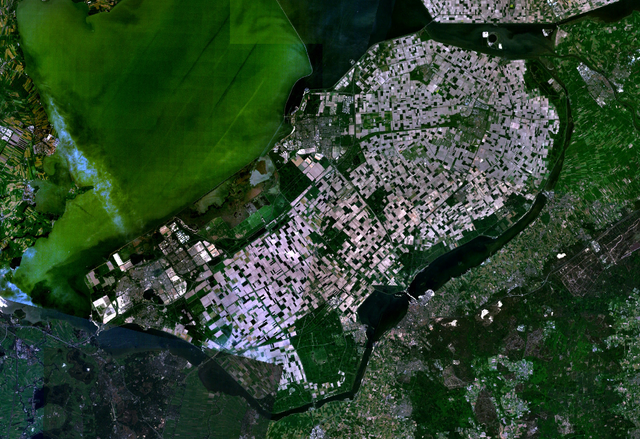
English: Satellite image of the Flevopolder in the Netherlands. Technically, the Flevopolder consists of Zuidelijk Flevoland (Southern Flevoland), Oostelijk Flevoland (Eastern Flevoland) and the Noordoostpolder (North Eastern Polder). This image shows Southern and Eastern Flevoland. |
| Source | Screenshot from NASA's World Wind |
| Author | Photograph: NASA |
| This image is in the public domain because it is a screenshot from NASA’s globe software World Wind using a public domain layer, such as Blue Marble, MODIS, Landsat, SRTM, USGS or GLOBE.
|
 |
File history
Click on a date/time to view the file as it appeared at that time.
| Date/Time | Dimensions | User | Comment | |
|---|---|---|---|---|
| current | 06:25, 4 May 2005 | 1,024 × 702 (1.49 MB) | Galwaygirl | Satellite image of the Flevopolder in the Netherlands. Screenshot from NASA's World Wind {{PD}} |
File usage
The following 2 pages use this file:
.png)