File:Spanish map of Mindanao.jpg
Spanish_map_of_Mindanao.jpg (524 × 331 pixels, file size: 29 KB, MIME type: image/jpeg)
| This is a file from the Wikimedia Commons. The description on its description page there is shown below.
|
Summary
| Description |
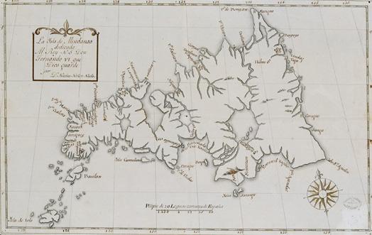
English: Spanish map of Mindanao. Oldest extant map featuring the newly named "Basilan" island. |
| Date | |
| Source | Own work |
| Author | Jjarivera |
Licensing
|
This work is in the public domain in its country of origin and other countries and areas where the copyright term is the author's life plus 70 years or fewer.
| |
| This file has been identified as being free of known restrictions under copyright law, including all related and neighboring rights. | |
File history
Click on a date/time to view the file as it appeared at that time.
| Date/Time | Dimensions | User | Comment | |
|---|---|---|---|---|
| current | 01:09, 13 August 2008 | 524 × 331 (29 KB) | Jjarivera~commonswiki | {{Information |Description={{en|1=Spanish map of Mindanao. Oldest extant map featuring the newly named "Basilan" island.}} |Source=Own work by uploader |Author=Jjarivera |Date=8.8.08 |Permission= |other_versions= }} <!--{{ImageUpload|f |
File usage
The following page uses this file: