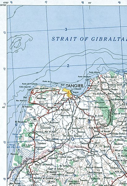
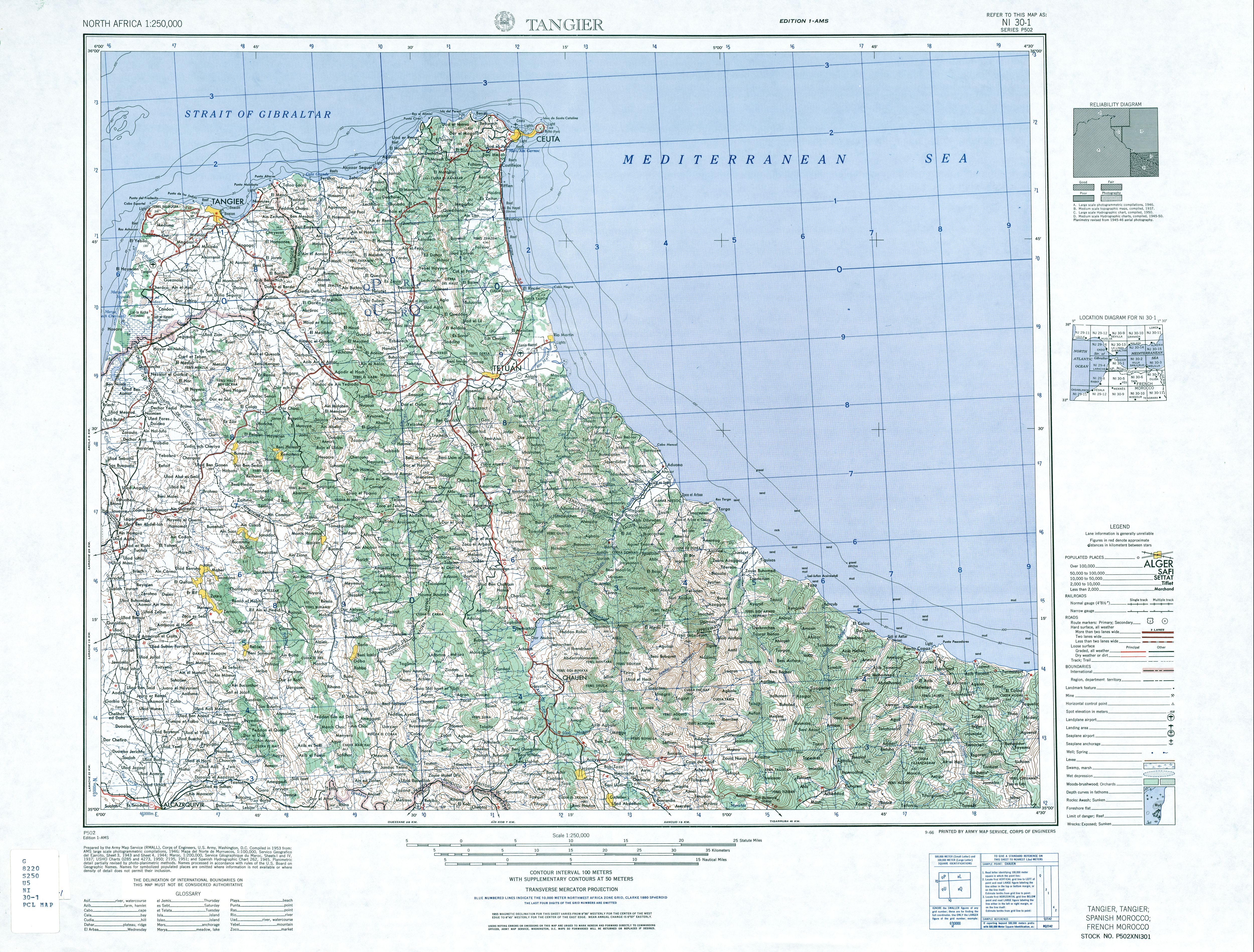
File:Tangier Zone txu-oclc-6949452-ni30-1.jpg

Size of this preview: 410 × 599 pixels. Other resolutions: 164 × 240 pixels | 329 × 480 pixels | 411 × 600 pixels | 949 × 1,386 pixels.
Original file (949 × 1,386 pixels, file size: 1.2 MB, MIME type: image/jpeg)
| This is a file from the Wikimedia Commons. The description on its description page there is shown below.
|
Summary
| Description |
English: map of the area of the former International Zone of Tangier, Morocco |
| Date | |
| Source | http://www.lib.utexas.edu/maps/ams/north_africa/txu-oclc-6949452-ni30-1.jpg |
| Author | Army Map Service |
Licensing
This file is a work of a U.S. Army soldier or employee, taken or made as part of that person's official duties. As a work of the U.S. federal government, it is in the public domain in the United States.
|
 |
-
File history
Click on a date/time to view the file as it appeared at that time.
| Date/Time | Dimensions | User | Comment | |
|---|---|---|---|---|
| current | 00:14, 29 November 2017 | 949 × 1,386 (1.2 MB) | ديفيد عادل وهبة خليل 2 | Removed border by cropping 3 % horizontally and 2 % vertically using CropTool with precise mode. |
File usage
The following page uses this file: