File:Traversing and Offsetting DP 79152.png
Size of this preview: 535 × 599 pixels. Other resolutions: 214 × 240 pixels | 429 × 480 pixels | 536 × 600 pixels | 893 × 1,000 pixels.
Original file (893 × 1,000 pixels, file size: 109 KB, MIME type: image/png)
| This is a file from the Wikimedia Commons. The description on its description page there is shown below.
|
Summary
| Description |
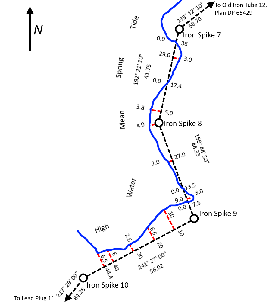
English: A simplified tracing of part of North Auckland Deposited Plan 79152 showing survey reference markers, traverse lines and offset measurements used to determine the location of a shoreline being used as a legal boundary line.
This work is based on/includes LINZ’s data which are licensed by Land Information New Zealand (LINZ) for re-use under the Creative Commons Attribution 3.0 New Zealand licence. |
| Date | |
| Source | This work is based on/includes LINZ’s data which are licensed by Land Information New Zealand (LINZ) for re-use under the Creative Commons Attribution 3.0 New Zealand licence. |
| Author | Land Information New Zealand, Derivative work by TBP25 |
Licensing
This file is licensed under the Creative Commons Attribution 3.0 Unported license.
- You are free:
- to share – to copy, distribute and transmit the work
- to remix – to adapt the work
- Under the following conditions:
- attribution – You must give appropriate credit, provide a link to the license, and indicate if changes were made. You may do so in any reasonable manner, but not in any way that suggests the licensor endorses you or your use.
File history
Click on a date/time to view the file as it appeared at that time.
| Date/Time | Dimensions | User | Comment | |
|---|---|---|---|---|
| current | 02:32, 23 July 2014 | 893 × 1,000 (109 KB) | TBP25 | Colour coded - red lines are offset measurements |
File usage
The following page uses this file: