File:Tularosa-Basin-NM-USGS-map opaque.gif
Size of this preview: 447 × 599 pixels. Other resolutions: 179 × 240 pixels | 624 × 836 pixels.
Original file (624 × 836 pixels, file size: 59 KB, MIME type: image/gif)
| This is a file from the Wikimedia Commons. The description on its description page there is shown below.
|
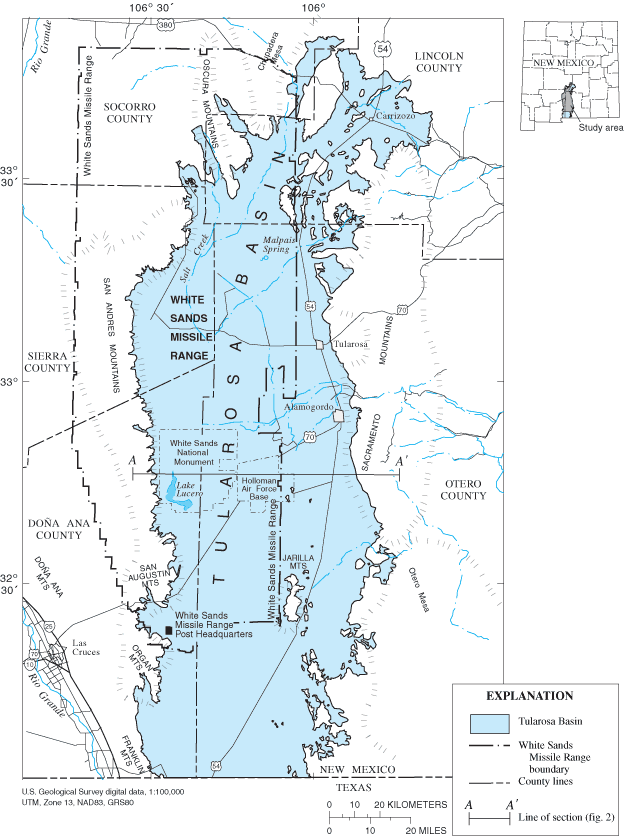
| Description | Location map of Tularosa Basin 2004. Huff, Glenn F. (2005) "Simulation of Ground-Water Flow in the Basin-Fill Aquifer of the Tularosa Basin, South-Central New Mexico, Predevelopment through 2040" Scientific Investigations Report 2004-5197, United States Geological Survey, Washongton, D.C., fig. 1. | |||
| Date | ||||
| Source |
USGS (https://pubs.er.usgs.gov/usgspubs/sir/sir20045197) http://pubs.usgs.gov/sir/2004/5197/ http://pubs.usgs.gov/sir/2004/5197/images/fig1.gif |
|||
| Author | Huff, Glenn F. (United States Geological Survey) | |||
| Permission (Reusing this file) |
|
|||
| Other versions | Image:Tularosa-Basin-NM-USGS-map.gif (transparent version) |
File history
Click on a date/time to view the file as it appeared at that time.
| Date/Time | Dimensions | User | Comment | |
|---|---|---|---|---|
| current | 05:50, 11 December 2007 | 624 × 836 (59 KB) | AnonMoos | actual opaque version |
File usage
The following page uses this file: