File:Txu-oclc-10552568-nh50-14-back.jpg
Size of this preview: 715 × 600 pixels. Other resolutions: 286 × 240 pixels | 572 × 480 pixels | 916 × 768 pixels | 1,221 × 1,024 pixels | 5,000 × 4,193 pixels.
Original file (5,000 × 4,193 pixels, file size: 2.7 MB, MIME type: image/jpeg)
| This is a file from the Wikimedia Commons. The description on its description page there is shown below.
|
Summary
| Description |
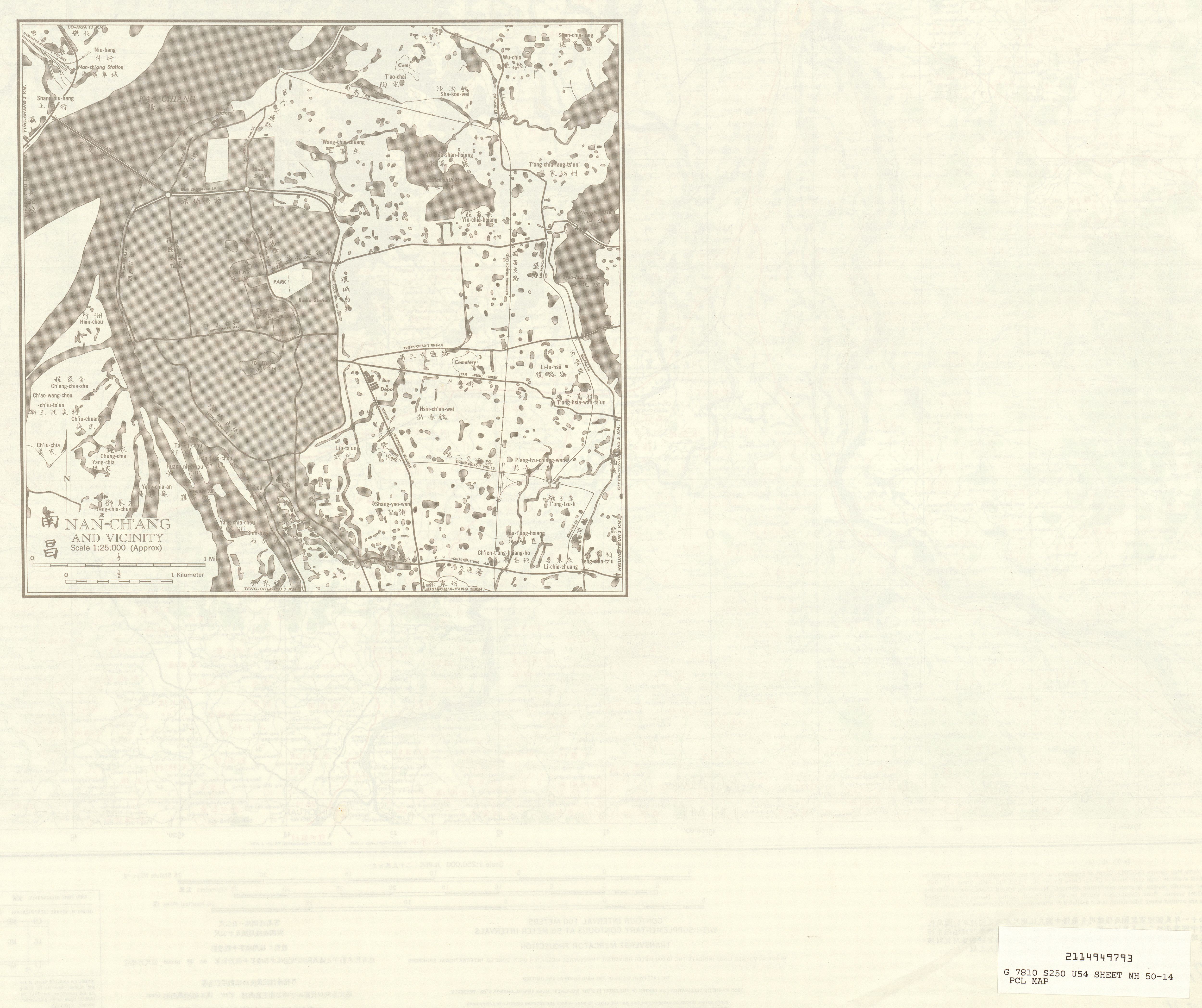
English: China AMS Topographic Maps |
| Date | 1950s |
| Source | Courtesy of the University of Texas Libraries, The University of Texas at Austin. |
| Author | Army Map Service, Corps of Engineers |
| Other versions |
|

Licensing
This image or file is a work of a U.S. Army Corps of Engineers soldier or employee, taken or made as part of that person's official duties. As a work of the U.S. federal government, the image is in the public domain.
|
File history
Click on a date/time to view the file as it appeared at that time.
| Date/Time | Dimensions | User | Comment | |
|---|---|---|---|---|
| current | 23:57, 12 September 2019 | 5,000 × 4,193 (2.7 MB) | Geographyinitiative | User created page with UploadWizard |
File usage
The following page uses this file: