File:Venezuela Falcón location map.svg

Size of this PNG preview of this SVG file: 512 × 343 pixels. Other resolutions: 320 × 214 pixels | 640 × 429 pixels | 800 × 536 pixels | 1,024 × 686 pixels | 1,280 × 858 pixels.
Original file (SVG file, nominally 512 × 343 pixels, file size: 4.36 MB)
| This is a file from the Wikimedia Commons. The description on its description page there is shown below.
|
Summary
![]() This SVG map is part of a locator map series applying the widespread location map scheme. Please see root category to browse for more.
This SVG map is part of a locator map series applying the widespread location map scheme. Please see root category to browse for more.
.svg)
.svg)
.svg)
.svg)
.svg)
.svg)
.svg)
Locator maps design recommendations ▼ | |
|---|---|
Principles
Design Guidelines are based on ▸location map design of the German map shop (in German). It's preferable to derive new locator maps from existing location maps. Please keep both size and ratio in this case. Thus the new locator maps may still be applied as location map (▸Guide). Marker color is supposed to be darkred. Waterbodies may be transparent, to show other objects better. Please be aware that this guide is only a recommendation. It’s not an inevitable law!
Highlight small areas
“Remote” areas and mini maps
Mini maps show where the depicted area actually is situated. Check out ▸Vorlage:Positionskarte+ (in German) and ▸Modèle:Carte en coin (in French) of how to insert a mini map in virtually every map.
Disputed areas
Greyed special objects
Backgrounds
|

-en.svg)

.svg)
.svg)
.svg)

_(US48).svg)
_(small_islands_magnified)_(-mini_map_-rivers).svg)
.svg)
_(extra_close)_(US48).svg)
.svg)
_(zoom).svg)

.svg)


_(UNMIK).svg)
.svg)
_(disputed_hatched).svg)
_(claimed_and_disputed_hatched).svg)
.svg)
.svg)
_(%2Ball_claims_hatched).svg)

.svg)
_(shade).svg)
_(shade)_(special_marker).svg)
_(-mini_map).svg)
_(-mini_map).svg)
_(-mini_map).svg)


.svg)

.svg)
Map legend
- FDFBEA → Marked territory
- F2F2F2 → Other state/provinces of Venezuela
- DFDFDF → Other countries
- 656564 → Lines/boundaries
- C7E7FB → Waterbodies
- 1278AB → Waterbodies border
- 279ECC → Rivers
- E8F2F7 → Wetlands (with dotted border)
Geographic limits of the map (EPSG:4326)
- N: 12.3830
- S: 10.1620
- W: 71.4081
- E: 68.0288
Data sources
- OpenStreetMap: Administrative borders
- US Tactical Pilotage Charts: Rivers and lakes
- SAGECAN 1994 map series: Rivers and lakes
Licensing
| Description |
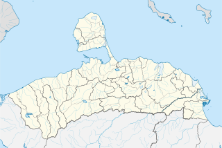
English: Locator map of Falcón, Venezuela |
|||||||||
| SVG development | This map was created with Adobe Illustrator. |
|||||||||
| Date | ||||||||||
| Source | OpenStreetMap data, extracted via QGIS software. | |||||||||
| Creator |
OpenStreetMap contributors |
|||||||||
| Permission (Reusing this file) |
OpenStreetMap data is available under the Open Database License (details). Standard style map tiles are licensed as ODbL Produced Works.
|
|||||||||
| Geotemporal data | ||||||||||
| Bounding box |
|
|||||||||
File history
Click on a date/time to view the file as it appeared at that time.
| Date/Time | Dimensions | User | Comment | |
|---|---|---|---|---|
| current | 06:45, 26 October 2023 | 512 × 343 (4.36 MB) | Wguayana | rivers and some waterbodies |
File usage
The following page uses this file: